Sites and Monuments Record · Ireland
Megalithic tomb - unclassified
Licketstown, County Kilkenny, Ireland
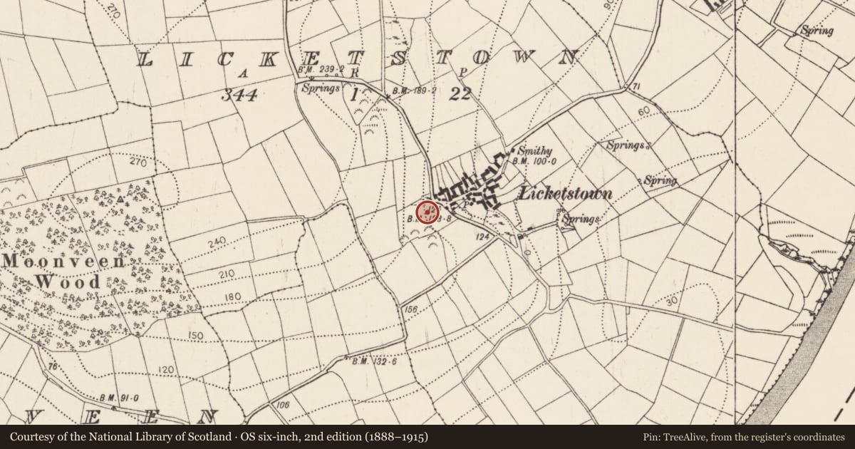
The record
- Townland
- Licketstown
- County
- Kilkenny
- Country
- Ireland
- First-edition OS map
- Not indicated
- Latest-edition OS map
- Not indicated
- Coordinates
- 52.25475, -7.20997
- SMR number
- KK045-015----
Slide toward Today to fade the historical sheet and see the modern map underneath.
David Rumsey Map Collection, Stanford LibrariesUniversity Library, Vrije Universiteit AmsterdamDavid Rumsey Map Collection, Stanford LibrariesDavid Rumsey Map Collection, Stanford Libraries
4 historical maps cover this location, the earliest the 1790 map "Composite: Ireland." (David Rumsey Map Collection, Stanford Libraries).
Historical maps covering this location
- 1790 · Composite: Ireland. (David Rumsey Map Collection, Stanford Libraries)
- 1882 · Ireland (southern half). (David Rumsey Map Collection, Stanford Libraries)
- 1891 · Ireland 16 (David Rumsey Map Collection, Stanford Libraries)
- 1911 · Sheet 14, 1911 (University Library, Vrije Universiteit Amsterdam)
This record in the National Monuments Service's Historic Environment Viewer ↗
The National Monuments Service's description
On the shoulder of a SE facing slope overlooking the River Suir. There are two different descriptions of this monument from the mid-19th century. It was reported in 1849 as being 'twenty-five feet [7.62m] long, and ten or twelve [3.05m or 3.66m] wide . . . The grave was lined with huge flags, and at the head and foot were enormous stones about sixteen feet [4.88m] in height' and that it was opened c. 1790 when a 'gigantic skeleton, with a huge sword, much rust-eaten . . . [and] a helmet of uncommon size' were found (Moore 1849, 13). In 1852 it was described as 'consisting of a cist or cavity about eight feet [2.44m] long, three feet [91cm] deep, and three feet [91cm] wide. A pile of stone now occupies the “narrow bed” of the hero, which bears about one point north-east, and from the position of four upright stones still remaining, it appears to have been surrounded by a row of such stones disposed in circular order, and enclosing an area of about twelve feet [3.66m] in diameter.' (Cody 1852, 101). According to local information the monument was destroyed about thirty years ago [c. 1960s] in the course of land reclamation. The exact nature of this site is uncertain and it cannot be classified with certainty as a megalithic tomb.
Compiled by: Paul Walsh
Date of upload: 12 May 2021
References
Moore, Rev. P. 1849-51 Giants' graves. No. I. Journal of the Royal Society of Antiquaries of Ireland 1, 11-14.
Cody, P. 1852 Folk-lore. No. II. Journal of the Royal Society of Antiquaries of Ireland 2, 97-102.
Nearby in the register
- Fulacht fiaunder 1 mi
- Burialunder 1 mi
- Enclosureunder 1 mi
- Kilnunder 1 mi
Other entries of the same register within about three miles of this one, by straight line.