Sites and Monuments Record · Ireland
Graveslab
Coolaghmore, County Kilkenny, Ireland
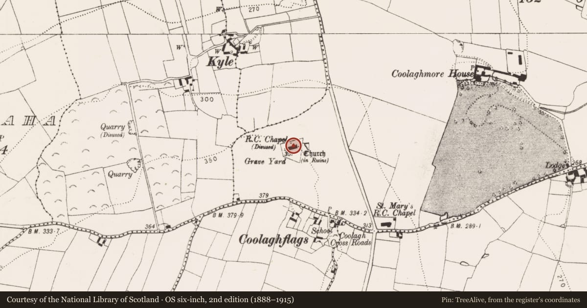
The record
- Townland
- Coolaghmore
- County
- Kilkenny
- Country
- Ireland
- First-edition OS map
- Not indicated
- Latest-edition OS map
- Not indicated
- Coordinates
- 52.50211, -7.38438
- SMR number
- KK030-004004-
Slide toward Today to fade the historical sheet and see the modern map underneath.
David Rumsey Map Collection, Stanford LibrariesDavid Rumsey Map Collection, Stanford LibrariesDavid Rumsey Map Collection, Stanford LibrariesDavid Rumsey Map Collection, Stanford Libraries
4 historical maps cover this location, the earliest the 1790 map "Composite: Ireland." (David Rumsey Map Collection, Stanford Libraries).
Historical maps covering this location
- 1790 · Composite: Ireland. (David Rumsey Map Collection, Stanford Libraries)
- 1869 · Ireland. (David Rumsey Map Collection, Stanford Libraries)
- 1882 · Ireland (southern half). (David Rumsey Map Collection, Stanford Libraries)
- 1891 · Ireland 16 (David Rumsey Map Collection, Stanford Libraries)
This record in the National Monuments Service's Historic Environment Viewer ↗
The National Monuments Service's description
On a NE-facing slope, in rough grazing with outcropping bedrock. Within a multiperiod church (KK030-004001-).
The church, which is aligned E-W, consists of a square chancel with a later nave occupying the space between the chancel and the residential tower (KK030-004002-) at the W end. There is a door connecting the chancel to the nave, into which this medieval graveslab (KK030-004004-) has been inset. The graveslab (L 1.88m; Wth at top 0.7m; Wth at base 0.66m; T 0.17m) is decorated with an incised interlace or bracelet cross-head within a double-lined circle and has a double-line border around the upper surface. The sides are moulded and include a horizontal band of nail-head decoration, though this does not continue on all sides.
There is another roughly rectangular medieval graveslab (KK030-004009-) in graveyard and Carrigan (1905, vol. 3, 336) mentions 'two uninscribed coffin-shaped slabs [KK030-004010- and KK030-004011-], with raised crosses' of 13th/14th century date in the graveyard, which appear to be in addition to the two graveslabs (KK030-004004- and KK030-004009-) identified during fieldwork.
Compiled by: Jean Farrelly
Date of upload: 18 July 2023
References
Carrigan, Rev. W. 1905 (Reprint 1981) The history and antiquities of the diocese of Ossory, 4 vols. Kilkenny. Roberts Books and Wellbrook Press.
Nearby in the register
- Sheela-na-gigunder 1 mi
- Fontunder 1 mi
- Churchunder 1 mi
- Graveslabunder 1 mi
Other entries of the same register within about three miles of this one, by straight line.