Sites and Monuments Record · Ireland
Graveyard
Kilree (Kells By.), County Kilkenny, Ireland
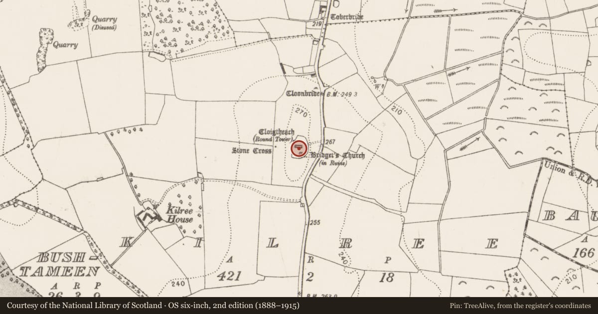
The record
- Townland
- Kilree (Kells By.)
- County
- Kilkenny
- Country
- Ireland
- First-edition OS map
- Indicated
- Latest-edition OS map
- Grave Yard
- Coordinates
- 52.51803, -7.26851
- SMR number
- KK027-044002-
Slide toward Today to fade the historical sheet and see the modern map underneath.
David Rumsey Map Collection, Stanford LibrariesDavid Rumsey Map Collection, Stanford LibrariesDavid Rumsey Map Collection, Stanford LibrariesDavid Rumsey Map Collection, Stanford Libraries
4 historical maps cover this location, the earliest the 1790 map "Composite: Ireland." (David Rumsey Map Collection, Stanford Libraries).
Historical maps covering this location
- 1790 · Composite: Ireland. (David Rumsey Map Collection, Stanford Libraries)
- 1869 · Ireland. (David Rumsey Map Collection, Stanford Libraries)
- 1882 · Ireland (southern half). (David Rumsey Map Collection, Stanford Libraries)
- 1891 · Ireland 16 (David Rumsey Map Collection, Stanford Libraries)
This record in the National Monuments Service's Historic Environment Viewer ↗
The National Monuments Service's description
On a flat-topped hill, surrounded by pasture. According to Carrigan (1905, vol. 4, 45), the name Kilree is derived from Cill Ruidhche, after St Ruidhche, a female saint who is commemorated on the 8th of February. A medieval church (KK027-044001-) dating to the 10th/11th century is centrally located within the graveyard, aligned E-W. There is a round tower (KK027-044003-) 7m NW of the church, along the W wall of the graveyard and a high cross (KK027-004404-) c. 40m W of the graveyard. The graveyard is roughly D-shaped (dims. 67m N-S; 43m E-W), with the roughly straight side to the W, aligned N-S, and the curving portion to the E. The graveyard is enclosed by a stone wall with the entrance on the E side, facing the public road. The earliest visible grave markers are within the chancel, consisting of two graveslabs (KK027-044007-; KK027-044008-) and a chest tomb (KK027-044006-).
Compiled by: Jean Farrelly
Date of upload: 30 January 2017
References
Carrigan, Rev. W. 1905 (Reprint 1981) The history and antiquities of the diocese of Ossory, 4 vols. Kilkenny. Roberts Books and Wellbrook Press.
Nearby in the register
- Churchunder 1 mi
- Graveslabunder 1 mi
- Tomb - chest tombunder 1 mi
- Graveslabunder 1 mi
Other entries of the same register within about three miles of this one, by straight line.