Sites and Monuments Record · Ireland
Moated site
Ballynaboley (Gowran By.), County Kilkenny, Ireland
The record
- Townland
- Ballynaboley (Gowran By.)
- County
- Kilkenny
- Country
- Ireland
- First-edition OS map
- Hachured
- Latest-edition OS map
- Hachured
- Coordinates
- 52.60081, -7.11520
- SMR number
- KK024-043----
Slide toward Today to fade the historical sheet and see the modern map underneath.
David Rumsey Map Collection, Stanford LibrariesUniversity Library, Vrije Universiteit AmsterdamDavid Rumsey Map Collection, Stanford LibrariesDavid Rumsey Map Collection, Stanford Libraries
4 historical maps cover this location, the earliest the 1790 map "Composite: Ireland." (David Rumsey Map Collection, Stanford Libraries).
Historical maps covering this location
- 1790 · Composite: Ireland. (David Rumsey Map Collection, Stanford Libraries)
- 1869 · Ireland. (David Rumsey Map Collection, Stanford Libraries)
- 1891 · Ireland 16 (David Rumsey Map Collection, Stanford Libraries)
- 1911 · Sheet 14, 1911 (University Library, Vrije Universiteit Amsterdam)
This record in the National Monuments Service's Historic Environment Viewer ↗
The National Monuments Service's description
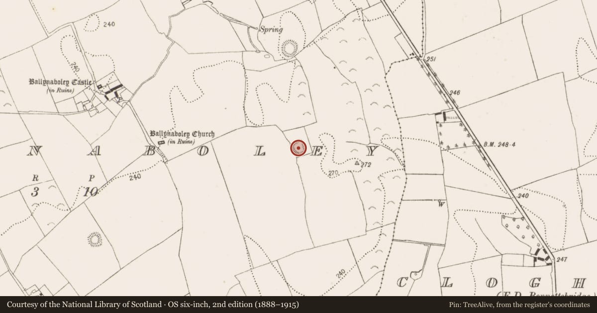
On raised ground at the base of a W-facing slope with good views from SSE-S-SW. Ballynaboley tower house (KK024-040----) is visible c. 600m to the NW. An area of marsh to the N and E, containing several springs, may originally have been the water source for the moat.
A subrectangular raised area (int. dims. 33.6m N-S; 25m E-W) enclosed by a bank (int. H 0.5m; ext. H 1.3m; overall Wth 3.9m) and a barely discernible external fosse (Wth c. 2.8m), the latter evident on all but the E side. The bank, which is slightly raised at the NW angle, is best preserved on the N, S and W sides and almost completely denuded on the E side. There is an entrance (Wth 3m) at the W end of the N side.
A crescentic hollow (L 12m; max. Wth 3.7m; max. D below interior 0.8m) runs from the SW angle, cutting across the bank, into the interior where it curves towards the S bank. A field boundary running N-S skirts the outer edge of the fosse on the W side. The bank and interior are clear of vegetation. There are a couple of large limestone boulders strewn about the interior.
Compiled by: Jean Farrelly
Date of upload: 28 September 2021
Nearby in the register
- Enclosureunder 1 mi
- Graveyardunder 1 mi
- Churchunder 1 mi
- Castle - tower houseunder 1 mi
Other entries of the same register within about three miles of this one, by straight line.