Sites and Monuments Record · Ireland
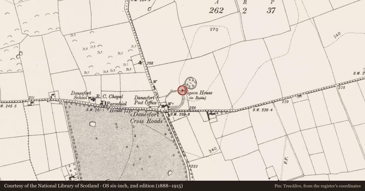
Dovecote
Pigeonpark, County Kilkenny, Ireland
The record
- Townland
- Pigeonpark
- County
- Kilkenny
- Country
- Ireland
- First-edition OS map
- Pigeon Ho.
- Latest-edition OS map
- Indicated
- Coordinates
- 52.58351, -7.23704
- SMR number
- KK023-059----
Slide toward Today to fade the historical sheet and see the modern map underneath.
David Rumsey Map Collection, Stanford LibrariesUniversity Library, Vrije Universiteit AmsterdamDavid Rumsey Map Collection, Stanford LibrariesDavid Rumsey Map Collection, Stanford Libraries
4 historical maps cover this location, the earliest the 1790 map "Composite: Ireland." (David Rumsey Map Collection, Stanford Libraries).
Historical maps covering this location
- 1790 · Composite: Ireland. (David Rumsey Map Collection, Stanford Libraries)
- 1869 · Ireland. (David Rumsey Map Collection, Stanford Libraries)
- 1891 · Ireland 16 (David Rumsey Map Collection, Stanford Libraries)
- 1911 · Sheet 14, 1911 (University Library, Vrije Universiteit Amsterdam)
This record in the National Monuments Service's Historic Environment Viewer ↗
The National Monuments Service's description
Located immediately NE of a large enclosure (KK023-058001-) and 25m SW of another enclosure (KK023-057----). Orpen (1909, 320-21) provides an extent of lands, ‘of Joan, Countess of Gloucester and Hertford, taken in 1307, the jurors say that there are within the manor of Dunfert “Within the enclosure one hall, one chamber, one dairy, one grange, one bretage beyond the gate, and other wooden houses”. They also mention “a dovecote,” perhaps at the same spot’.
A circular dovecote (diam. c. 7m), only the N section of walling survives (H 5.5m) and this is corbelled towards the top. There are remnants of pigeon holes internally, starting c. 0.6m above ground level and running in vertical lines c. 0.3m apart. They have narrow entrances but are wider inside and they are divided from each other by thin stone flags which act as lintels. The exterior was harled. Two bricks were noted in the fabric, possibly indicating a date around the 16th/17th century for the structure.
Compiled by: Jean Farrelly
Date of upload: 18 August 2021
References
Orpen, G.H. 1909 Motes and Norman castles in Ossory. Journal of the Royal Society of Antiquaries of Ireland 39, 313-42.
Nearby in the register
Other entries of the same register within about three miles of this one, by straight line.