Sites and Monuments Record · Ireland
Castle - ringwork
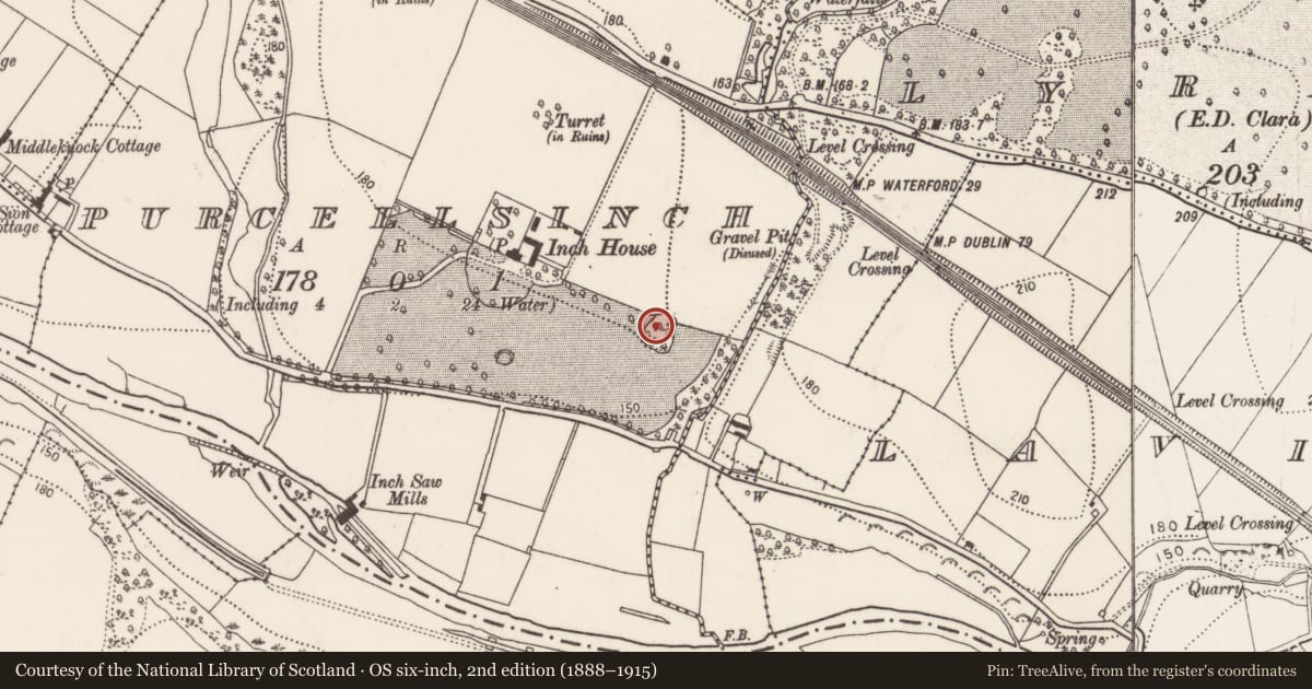
Purcellsinch, County Kilkenny, Ireland
The record
- Townland
- Purcellsinch
- County
- Kilkenny
- Country
- Ireland
- First-edition OS map
- Indicated
- Latest-edition OS map
- Indicated
- Coordinates
- 52.64279, -7.20969
- SMR number
- KK019-103----
Slide toward Today to fade the historical sheet and see the modern map underneath.
David Rumsey Map Collection, Stanford LibrariesUniversity Library, Vrije Universiteit AmsterdamDavid Rumsey Map Collection, Stanford LibrariesDavid Rumsey Map Collection, Stanford Libraries
4 historical maps cover this location, the earliest the 1790 map "Composite: Ireland." (David Rumsey Map Collection, Stanford Libraries).
Historical maps covering this location
- 1790 · Composite: Ireland. (David Rumsey Map Collection, Stanford Libraries)
- 1869 · Ireland. (David Rumsey Map Collection, Stanford Libraries)
- 1891 · Ireland 16 (David Rumsey Map Collection, Stanford Libraries)
- 1911 · Sheet 14, 1911 (University Library, Vrije Universiteit Amsterdam)
This record in the National Monuments Service's Historic Environment Viewer ↗
The National Monuments Service's description
At the S end of an N-S ridge, beyond which the ground slopes down to a stream c. 90m to the W and slopes towards the River Nore c. 400m to the S. A raised roughly round platform (diam. 40m E-W; 44m N-S; H 1-1.5m on N and E sides; H 3m gradual fall on W side) which on the S side it is enclosed by a wide flat-bottomed fosse (Wth 3.5m) and outer bank (Wth 4m; H 0.5m). The surface of the platform is relatively flat and slopes slightly to the W. There are beech trees around the edge of the platform and bushes and scrub on the N side. On the S side the beech trees are on a stepped down berm (Wth 1.5m) 0.4m lower than the edge of the platform. There has been some ground disturbance on the E side where field boundaries were removed. A discussion of this monument, together with a plan and section, has been published by Neary (2005, 106-08).
Compiled by: Jean Farrelly
Date of upload: 6 December 2016
References
Neary, P. J. H. 2005 A newly discovered Anglo-Norman ringwork castle from Purcell's Inch townland, Kilkenny. Old Kilkenny Review 57, 106-08.
Nearby in the register
- Kiln - limeunder 1 mi
- Designed landscape - tree-ringunder 1 mi
- Designed landscape - follyunder 1 mi
- Enclosureunder 1 mi
Other entries of the same register within about three miles of this one, by straight line.