Sites and Monuments Record · Ireland
Burial
Gardens (Kilkenny City By., St. Canice Par.), County Kilkenny, Ireland
The record
- Townland
- Gardens (Kilkenny City By., St. Canice Par.)
- County
- Kilkenny
- Country
- Ireland
- First-edition OS map
- Not indicated
- Latest-edition OS map
- Not indicated
- Coordinates
- 52.65679, -7.25678
- SMR number
- KK019-026234-
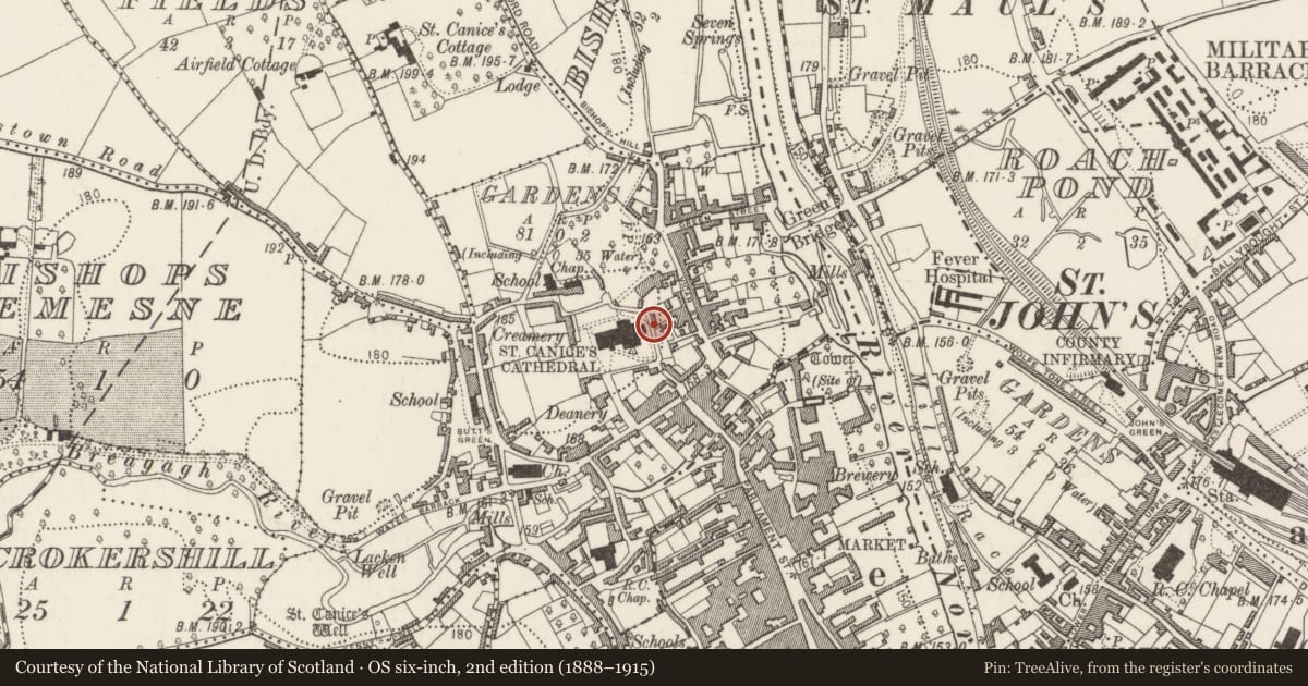
Slide toward Today to fade the historical sheet and see the modern map underneath.
David Rumsey Map Collection, Stanford LibrariesUniversity Library, Vrije Universiteit AmsterdamDavid Rumsey Map Collection, Stanford LibrariesDavid Rumsey Map Collection, Stanford Libraries
4 historical maps cover this location, the earliest the 1790 map "Composite: Ireland." (David Rumsey Map Collection, Stanford Libraries).
Historical maps covering this location
- 1790 · Composite: Ireland. (David Rumsey Map Collection, Stanford Libraries)
- 1869 · Ireland. (David Rumsey Map Collection, Stanford Libraries)
- 1891 · Ireland 16 (David Rumsey Map Collection, Stanford Libraries)
- 1911 · Sheet 14, 1911 (University Library, Vrije Universiteit Amsterdam)
This record in the National Monuments Service's Historic Environment Viewer ↗
The National Monuments Service's description
Early medieval human burials uncovered in archaeological monitoring (09E0457) of mechanical trench excavations for a gas pipeline on Church Lane, 12m E of the E wall of the chancel of St Canice's Cathedral, within the former extent of the medieval graveyard (KK019-026171-) associated with St Canices’s Cathedral (KK019-026029-). Three in-situ adult (sex unknown) articulated human burials, orientated E-W with their heads to the W, were recorded, and radiocarbon dated to the mid-7th – mid-10th century: Burial 1 AD 730-940; Burial 2 AD 690-890; Burial 3 AD 660-780. An antler tine offcut recovered near to the burials was radiocarbon dated to AD 900-1020. Disarticulated human bone was also recorded. The burials were fully excavated from the service trench but what remained in the trench sections was left in situ. It is clear from the amount of disarticulated human bone found in the excavation and in a separately monitored service trench (04E1535) 25m to the S that further interments are likely to be present along Church Lane (Ó Drisceoil 2004, unpublished).
Compiled by: Cóilín Ó Drisceoil
Date of upload: 5 November 2020
References
Ó Drisceoil, C. 2004 Archaeological monitoring: gas pipe trench Church Lane, Kilkenny, licence 04E1535. Unpublished report. Kilkenny Archaeology.
Nearby in the register
Other entries of the same register within about three miles of this one, by straight line.