Sites and Monuments Record · Ireland
Graveyard
Kilmanagh, County Kilkenny, Ireland
The record
- Townland
- Kilmanagh
- County
- Kilkenny
- Country
- Ireland
- First-edition OS map
- Grave Yd.
- Latest-edition OS map
- Indicated
- Coordinates
- 52.62102, -7.42814
- SMR number
- KK018-066005-
Slide toward Today to fade the historical sheet and see the modern map underneath.
David Rumsey Map Collection, Stanford LibrariesDavid Rumsey Map Collection, Stanford LibrariesDavid Rumsey Map Collection, Stanford LibrariesDavid Rumsey Map Collection, Stanford Libraries
4 historical maps cover this location, the earliest the 1790 map "Composite: Ireland." (David Rumsey Map Collection, Stanford Libraries).
Historical maps covering this location
- 1790 · Composite: Ireland. (David Rumsey Map Collection, Stanford Libraries)
- 1869 · Ireland. (David Rumsey Map Collection, Stanford Libraries)
- 1891 · Ireland 16 (David Rumsey Map Collection, Stanford Libraries)
- 1904 · Sheet 13. (David Rumsey Map Collection, Stanford Libraries)
This record in the National Monuments Service's Historic Environment Viewer ↗
The National Monuments Service's description
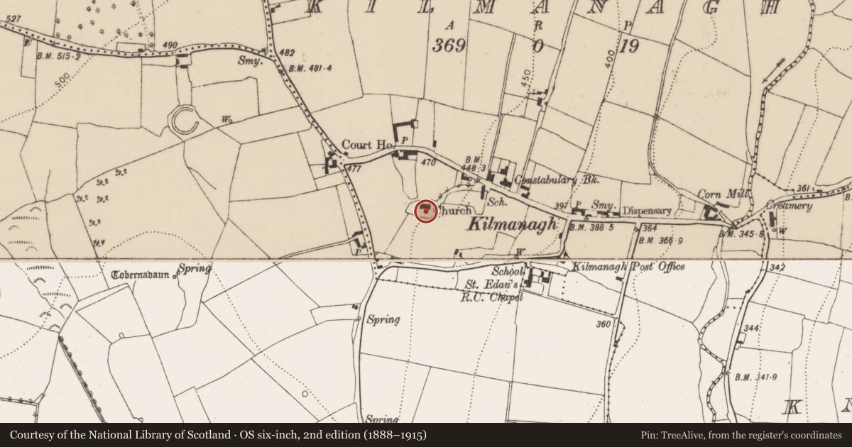
Associated with the medieval church (KK018-066001-) of Kilmanagh which was replaced by a C of I church in the late 18th century (Carrigan 1905, vol. 3, 431). On the 1st (1839) ed. OS 6-inch map the graveyard is indicated by a dashed line enclosing a roughly rectangular area, though the dashing continues around the school house and surrounds to the NE and runs northward to include houses and gardens on the S side of the main street, presumably all church property. The dashed line suggests that these areas, including the graveyard were not enclosed. By the 1900 revision the graveyard is indicated as being enclosed and accessed by a long curving avenue from the main street to the NE, entered immediately W of the school house. The school house is now gone but the entrance remains at this location, with stone piers and a wall on either side. In the graveyard Carrigan (ibid.) noted, 'a very large number of inscribed monuments, but none of them are of earlier date than the 18th century'. The graveyard is enclosed by a stone wall and on the N side there is an architectural fragment (KK018-066002-), with punch tooling which suggests a late medieval date, which is likely to have come from the medieval church.
Compiled by: Jean Farrelly
Date of upload: 31 March 2021
References
Carrigan, Rev. W. 1905 (Reprint 1981) The history and antiquities of the diocese of Ossory, 4 vols. Kilkenny. Roberts Books and Wellbrook Press.
Nearby in the register
- Churchunder 1 mi
- Architectural fragmentunder 1 mi
- Settlement clusterunder 1 mi
- Earthworkunder 1 mi
Other entries of the same register within about three miles of this one, by straight line.