Sites and Monuments Record · Ireland
Water mill - vertical-wheeled
Freshford Lots, County Kilkenny, Ireland
The record
- Townland
- Freshford Lots
- County
- Kilkenny
- Country
- Ireland
- First-edition OS map
- Four Mills
- Latest-edition OS map
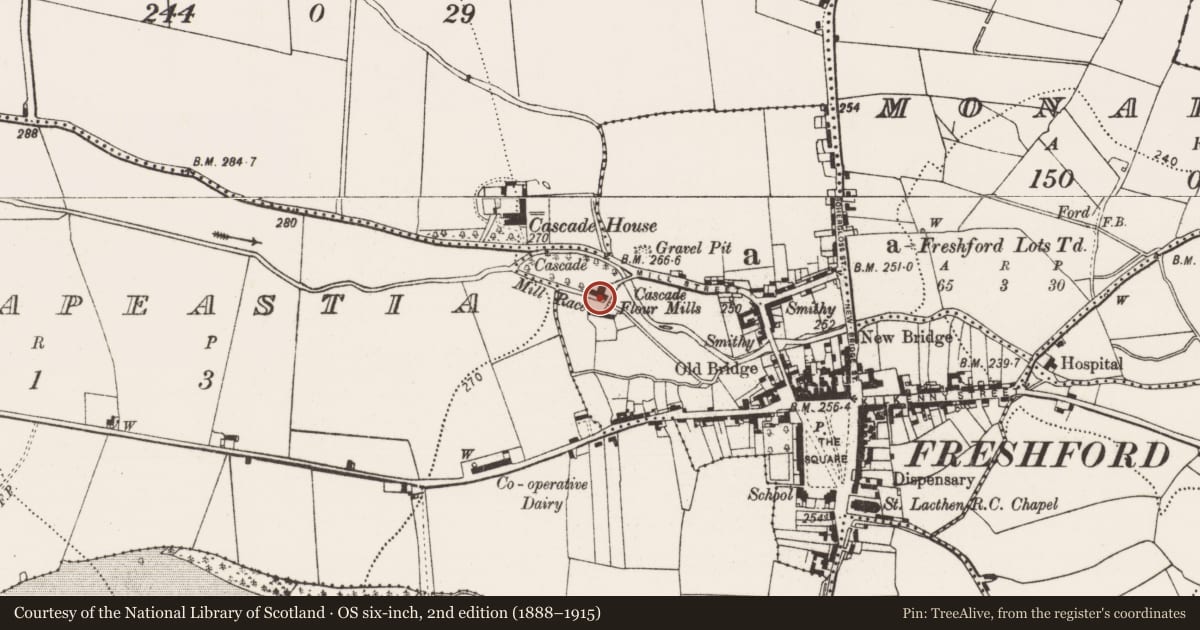
- Cascade Flour Mills
- Coordinates
- 52.73386, -7.40366
- SMR number
- KK013-089----
Slide toward Today to fade the historical sheet and see the modern map underneath.
David Rumsey Map Collection, Stanford LibrariesDavid Rumsey Map Collection, Stanford LibrariesDavid Rumsey Map Collection, Stanford LibrariesDavid Rumsey Map Collection, Stanford Libraries
4 historical maps cover this location, the earliest the 1790 map "Composite: Ireland." (David Rumsey Map Collection, Stanford Libraries).
Historical maps covering this location
- 1790 · Composite: Ireland. (David Rumsey Map Collection, Stanford Libraries)
- 1811 · Ireland. (David Rumsey Map Collection, Stanford Libraries)
- 1869 · Ireland. (David Rumsey Map Collection, Stanford Libraries)
- 1891 · Ireland 16 (David Rumsey Map Collection, Stanford Libraries)
This record in the National Monuments Service's Historic Environment Viewer ↗
The National Monuments Service's description
A watermill is depicted on the Down Survey (1655-6) parish map of Freshford (Hibernia Regnum, courtesy of Trinity College Dublin) c. 100 perches (c. 500m) NW of Freshford church (KK013-023001-) on the Nuenna River. This location roughly corresponds to that of the Cascade flour mills depicted on the 1st (1839) ed. OS 6-inch map, on the N side of a mill race which runs NW-SE S of the main river immediately NW of Freshford. This mill has since been demolished. The watermill which is depicted on the 17th map may be on the location of or in the immediate vicinity of this later mill.
Compiled by: Jean Farrelly
Date of upload: 30 March 2020
References
Hibernia Regnum: A set of 214 barony maps of Ireland dating to the period AD 1655-59. The original parish maps have been lost but the Hibernia Regnum maps are preserved in the Bibliotheque Nationale, Paris (Goblet 1932, v-x). Photographic facsimiles of these maps were published by the Ordnance Survey, Southampton in 1908.
Nearby in the register
- Cross - Wayside cross (present location)under 1 mi
- Cross - Wayside crossunder 1 mi
- Historic townunder 1 mi
- Fontunder 1 mi
Other entries of the same register within about three miles of this one, by straight line.