Sites and Monuments Record · Ireland
House - 17th century
Killahy (Crannagh By.), County Kilkenny, Ireland
The record
- Townland
- Killahy (Crannagh By.)
- County
- Kilkenny
- Country
- Ireland
- First-edition OS map
- Indicated
- Latest-edition OS map
- Indicated
- Coordinates
- 52.68566, -7.47935
- SMR number
- KK013-069003-
Slide toward Today to fade the historical sheet and see the modern map underneath.
David Rumsey Map Collection, Stanford LibrariesDavid Rumsey Map Collection, Stanford LibrariesDavid Rumsey Map Collection, Stanford LibrariesDavid Rumsey Map Collection, Stanford Libraries
4 historical maps cover this location, the earliest the 1790 map "Composite: Ireland." (David Rumsey Map Collection, Stanford Libraries).
Historical maps covering this location
- 1790 · Composite: Ireland. (David Rumsey Map Collection, Stanford Libraries)
- 1869 · Ireland. (David Rumsey Map Collection, Stanford Libraries)
- 1891 · Ireland 16 (David Rumsey Map Collection, Stanford Libraries)
- 1904 · Sheet 13. (David Rumsey Map Collection, Stanford Libraries)
This record in the National Monuments Service's Historic Environment Viewer ↗
The National Monuments Service's description
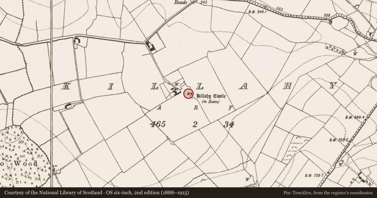
On the floor of a valley, in mostly reclaimed grassland. According to Carrigan (1905, vol. 2, 376), 'Beside it [Killahy castle KK013-069001-] are the extensive ruins of a fine mansion of about the year 1700'. A building located c. 4.5m NW of the castle is possibly the 'mansion' referred to by Carrigan. It is indicated as roofed on the 1st (1839) and as ruinous on the subsequent 1900 revision OS 6-inch map. On the 25-inch OS map only the SE wall (L c. 14m) and the NE and SW gables (Wth c. 4m) are depicted with a roofless square chamber at the SW end. Another building (dims. c. 26m x 6m) c. 40m to the NW of the castle may also be a candidate for the 'mansion', it is roofed on the 1st ed. 6-inch OS map and in ruins by the 1900 edition. The house is not visible at ground level.
Compiled by: Jean Farrelly
Date of upload: 21 December 2016
References
Carrigan, Rev. W. 1905 (Reprint 1981) The history and antiquities of the diocese of Ossory, 4 vols. Kilkenny. Roberts Books and Wellbrook Press.
Nearby in the register
- Castle - unclassifiedunder 1 mi
- Fish-pondunder 1 mi
- Churchunder 1 mi
- Graveyardunder 1 mi
Other entries of the same register within about three miles of this one, by straight line.