Sites and Monuments Record · Ireland
Graveyard
Greenhill, County Kilkenny, Ireland
The record
- Townland
- Greenhill
- County
- Kilkenny
- Country
- Ireland
- First-edition OS map
- Grave Yard
- Latest-edition OS map
- Indicated
- Coordinates
- 52.68993, -7.47770
- SMR number
- KK013-067002-
Slide toward Today to fade the historical sheet and see the modern map underneath.
David Rumsey Map Collection, Stanford LibrariesDavid Rumsey Map Collection, Stanford LibrariesDavid Rumsey Map Collection, Stanford LibrariesDavid Rumsey Map Collection, Stanford Libraries
4 historical maps cover this location, the earliest the 1790 map "Composite: Ireland." (David Rumsey Map Collection, Stanford Libraries).
Historical maps covering this location
- 1790 · Composite: Ireland. (David Rumsey Map Collection, Stanford Libraries)
- 1869 · Ireland. (David Rumsey Map Collection, Stanford Libraries)
- 1891 · Ireland 16 (David Rumsey Map Collection, Stanford Libraries)
- 1904 · Sheet 13. (David Rumsey Map Collection, Stanford Libraries)
This record in the National Monuments Service's Historic Environment Viewer ↗
The National Monuments Service's description
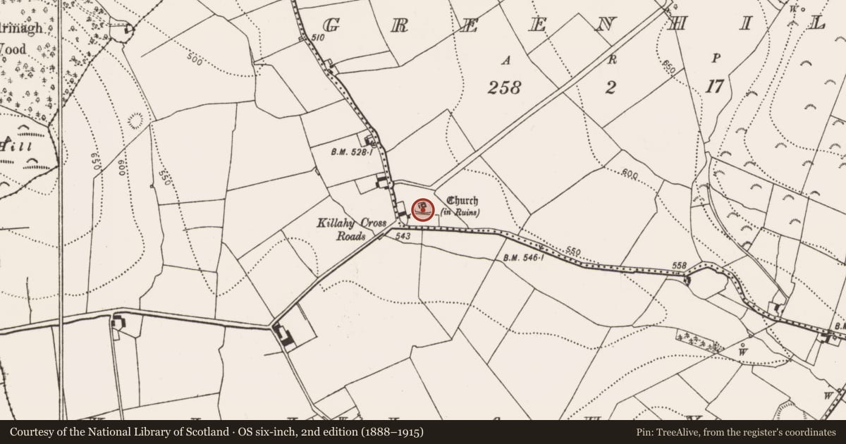
On a small hillock in a N-S valley, in reclaimed grassland. On the 1st (1839) ed. OS 6-inch map the graveyard is drawn as a dashed line encircling the church, indicating that there was not a physical graveyard enclosure. Moore (1874-9, 45) refers to a possible ogham stone (KK013-067003-) which was uncovered in the immediate vicinity and placed in the 'church-yard', 'but the workmen, when enclosing the burial-grounds, came upon it, and, through ignorance of its worth, sent it in pieces'. Moore (ibid.) also mentions that a fragment of the ogham was inserted as a quoin stone in the N angle of the graveyard. This suggests that the graveyard wall was built between 1839 and 1874. An irregularly shaped, straight-sided graveyard (c. 33m E-W; c. 22m N-S) with the remains of a church (KK013-067001-) roughly centrally placed in the N portion. The graveyard is maintained and in good condition. A possible ogham stone (KK013-067003-) was found in an adjacent outhouse.
Compiled by: Jean Farrelly
Date of upload: 24 March 2020
References
Moore, Very Rev. Canon 1874-9 Parochial papers. Transactions of the Ossory Archaeological Society 1, 23-40, 45.
Nearby in the register
- Ogham stoneunder 1 mi
- Churchunder 1 mi
- Castle - unclassifiedunder 1 mi
- House - 17th centuryunder 1 mi
Other entries of the same register within about three miles of this one, by straight line.