Sites and Monuments Record · Ireland
Settlement deserted - medieval
Rathealy, County Kilkenny, Ireland
The record
- Townland
- Rathealy
- County
- Kilkenny
- Country
- Ireland
- First-edition OS map
- Not indicated
- Latest-edition OS map
- Not indicated
- Coordinates
- 52.69482, -7.43051
- SMR number
- KK013-060004-
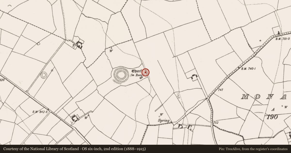
Slide toward Today to fade the historical sheet and see the modern map underneath.
David Rumsey Map Collection, Stanford LibrariesDavid Rumsey Map Collection, Stanford LibrariesDavid Rumsey Map Collection, Stanford LibrariesDavid Rumsey Map Collection, Stanford Libraries
4 historical maps cover this location, the earliest the 1790 map "Composite: Ireland." (David Rumsey Map Collection, Stanford Libraries).
Historical maps covering this location
- 1790 · Composite: Ireland. (David Rumsey Map Collection, Stanford Libraries)
- 1869 · Ireland. (David Rumsey Map Collection, Stanford Libraries)
- 1891 · Ireland 16 (David Rumsey Map Collection, Stanford Libraries)
- 1904 · Sheet 13. (David Rumsey Map Collection, Stanford Libraries)
This record in the National Monuments Service's Historic Environment Viewer ↗
The National Monuments Service's description
In rolling grassland at transition from slope of valley side to fairly flat valley floor. Moderate views along and across valley. According to Carrigan (1905, vol. 3, 497), 'In the field to the east of the church are many traces of buildings; also a square enclosure within which, no doubt, the castle of Rathealy stood'. Field inspection in 1987 found that the field to the E of the church had been reclaimed and no traces of structures or enclosures were visible (National Monuments files). However, field inspection in 1987 did identify two structures, one (KK013-060005-) within the graveyard (KK013-060002-) towards the E end of the northern boundary and another structure (KK013-060006-) c. 10m NNE of the NE angle of the graveyard. Immediately N of the latter structure there is a wide bank which may be part of a possible hollow-way (KK013-060007-)running roughly E-W towards the entrance to the ringwork (KK013-059001-), though only a short length is visible, the western portion possibly removed when the later, post-graveyard, large enclosure was constructed.
Compiled by: Jean Farrelly
Date of upload: 25 June 2015
Nearby in the register
- Buildingunder 1 mi
- Buildingunder 1 mi
- Road - hollow-wayunder 1 mi
- Churchunder 1 mi
Other entries of the same register within about three miles of this one, by straight line.