Sites and Monuments Record · Ireland
Graveyard
Muckalee, County Kilkenny, Ireland
The record
- Townland
- Muckalee
- County
- Kilkenny
- Country
- Ireland
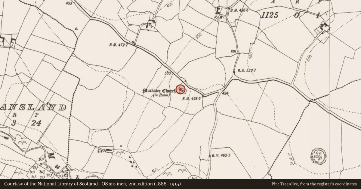
- First-edition OS map
- Grave Yard
- Latest-edition OS map
- Grave Yard
- Coordinates
- 52.74963, -7.21081
- SMR number
- KK010-069002-
Slide toward Today to fade the historical sheet and see the modern map underneath.
David Rumsey Map Collection, Stanford LibrariesDavid Rumsey Map Collection, Stanford LibrariesDavid Rumsey Map Collection, Stanford LibrariesDavid Rumsey Map Collection, Stanford Libraries
4 historical maps cover this location, the earliest the 1790 map "Composite: Ireland." (David Rumsey Map Collection, Stanford Libraries).
Historical maps covering this location
- 1790 · Composite: Ireland. (David Rumsey Map Collection, Stanford Libraries)
- 1811 · Ireland. (David Rumsey Map Collection, Stanford Libraries)
- 1869 · Ireland. (David Rumsey Map Collection, Stanford Libraries)
- 1891 · Ireland 16 (David Rumsey Map Collection, Stanford Libraries)
This record in the National Monuments Service's Historic Environment Viewer ↗
The National Monuments Service's description
On a N-S ridge between the Dinin river valley to the W, Douglas river valley to the S, and a small valley to the E. The graveyard (dims. 25m N-S; 45m E-W) occupies one of the irregular humps at the S end of the ridge and has a commanding view across all three valleys. A medieval church (KK010-069001-) is centrally placed within a roughly rectangular graveyard. The graveyard is enclosed by a stone wall with an entrance gate at the E end of the N wall. The ground within the graveyard and church has been significantly raised as a result of successive burials over a long period. At the eastern end of the graveyard, approximately 5m in from the N and E wall the ground level within the graveyard rises by c. 2m and is revetted by a stone wall, now in various states of collapse. Upstanding headstones, occupying both the ruined church and the graveyard, date to the 18th and 19th centuries. Given the close proximity to a church and graveyard seven trenches were opened in 2004 in advance of house building, however, no archaeological remains were found.
Compiled by: Jean Farrelly
Date of upload: 16 November 2016
Nearby in the register
- Churchunder 1 mi
- Fulacht fiaunder 1 mi
- Fulacht fiaunder 1 mi
- Fulacht fiaunder 1 mi
Other entries of the same register within about three miles of this one, by straight line.