Sites and Monuments Record · Ireland
Cross-slab
Coolcashin, County Kilkenny, Ireland
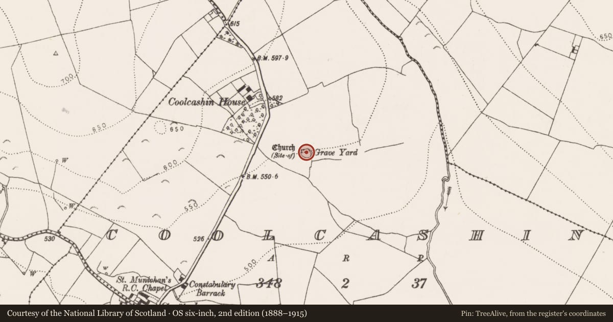
The record
- Townland
- Coolcashin
- County
- Kilkenny
- Country
- Ireland
- First-edition OS map
- Not indicated
- Latest-edition OS map
- Not indicated
- Coordinates
- 52.77123, -7.46560
- SMR number
- KK009-019010-
Slide toward Today to fade the historical sheet and see the modern map underneath.
David Rumsey Map Collection, Stanford LibrariesDavid Rumsey Map Collection, Stanford LibrariesDavid Rumsey Map Collection, Stanford LibrariesDavid Rumsey Map Collection, Stanford Libraries
4 historical maps cover this location, the earliest the 1790 map "Composite: Ireland." (David Rumsey Map Collection, Stanford Libraries).
Historical maps covering this location
- 1790 · Composite: Ireland. (David Rumsey Map Collection, Stanford Libraries)
- 1811 · Ireland. (David Rumsey Map Collection, Stanford Libraries)
- 1869 · Ireland. (David Rumsey Map Collection, Stanford Libraries)
- 1891 · Ireland 16 (David Rumsey Map Collection, Stanford Libraries)
This record in the National Monuments Service's Historic Environment Viewer ↗
The National Monuments Service's description
On a gentle E-facing slope, just below the crest of a hill, in rolling grassland, c. 50m NE of a stream which flows into a river c. 400m to the E. In the graveyard (KK009-013002-) associated with the medieval church of Coolcashin (KK009-013001-) and another cross-slab (KK009-019009-) from that graveyard. A small fragment of a rectangular sandstone cross-slab (dims. 0.21m x 0.2m; T 0.045m) with a straight-sided edge. The smooth flat surface is decorated with a number of straight incised lines indicating a border and within this frame there is the start of a double-lined curve, presumably the semi-circular terminal of one arm of a Latin cross. On the flat underside there are traces of mortar where the stone has been re-used in building a stone wall, presumably the graveyard wall at Coolcashin (KK009-019002-). Harney (2011, 124) refers to similar cross-slabs from Clonmacnoise which have a suggested date of late 9th-10th century and from High Island, Co. Galway which have been dated to the 10th/11th century based on the radiocarbon dates from associated burials. The cross-slab is currently located at the parochial house in Lisdowney (see KK009-123----).
Compiled by: Jean Farrelly
Date of revised upload: 20 July 2018
References
Harney, L. 2011 Medieval burial and pilgrimage within the landscape of Glendalough: the evidence of the crosses and cross-slabs. In C. Doherty, L. Doran and M. Kelly (eds), Glendalough: city of God, 112-36. Dublin. Four Courts Press.
Nearby in the register
- Cross-slabunder 1 mi
- Graveyardunder 1 mi
- Churchunder 1 mi
- Graveslabunder 1 mi
Other entries of the same register within about three miles of this one, by straight line.