Sites and Monuments Record · Ireland
Graveyard
Coolcashin, County Kilkenny, Ireland
The record
- Townland
- Coolcashin
- County
- Kilkenny
- Country
- Ireland
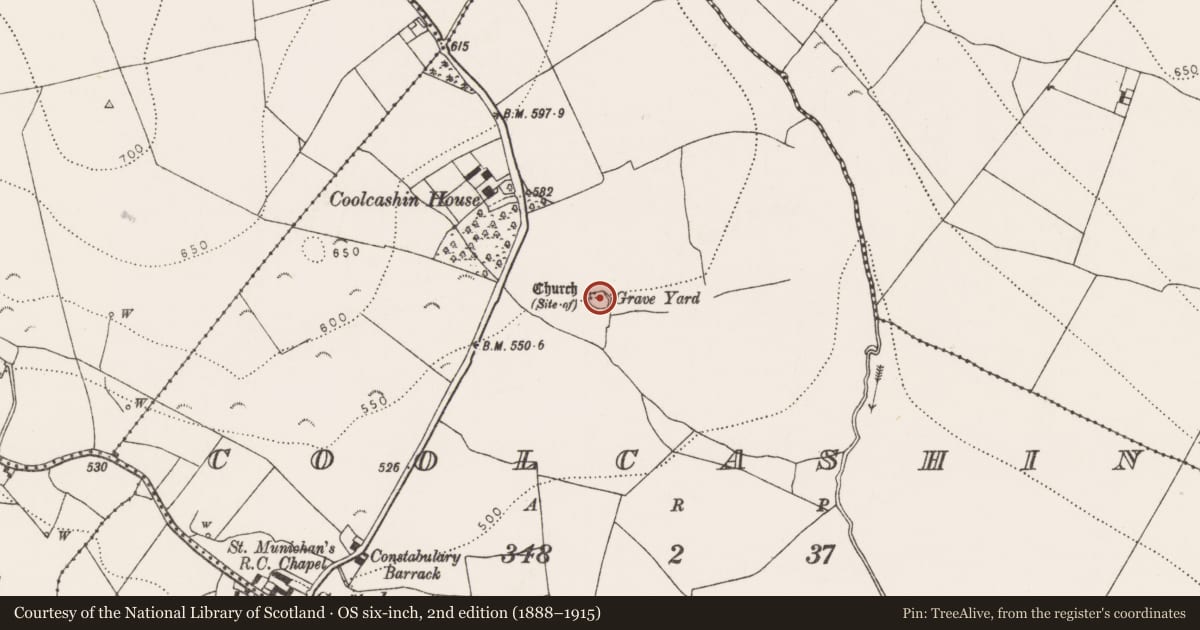
- First-edition OS map
- Grave Yard
- Latest-edition OS map
- Grave Yard
- Coordinates
- 52.77123, -7.46560
- SMR number
- KK009-019002-
Slide toward Today to fade the historical sheet and see the modern map underneath.
David Rumsey Map Collection, Stanford LibrariesDavid Rumsey Map Collection, Stanford LibrariesDavid Rumsey Map Collection, Stanford LibrariesDavid Rumsey Map Collection, Stanford Libraries
4 historical maps cover this location, the earliest the 1790 map "Composite: Ireland." (David Rumsey Map Collection, Stanford Libraries).
Historical maps covering this location
- 1790 · Composite: Ireland. (David Rumsey Map Collection, Stanford Libraries)
- 1811 · Ireland. (David Rumsey Map Collection, Stanford Libraries)
- 1869 · Ireland. (David Rumsey Map Collection, Stanford Libraries)
- 1891 · Ireland 16 (David Rumsey Map Collection, Stanford Libraries)
This record in the National Monuments Service's Historic Environment Viewer ↗
The National Monuments Service's description
On a gentle E-facing slope, just below the crest of a hill, in rolling grassland, c. 50m NE of a stream which flows into a river c. 400m to the E. On the 1st (1839) ed. OS 6-inch map a medieval church (KK009-019001-), orientated E-W, is built along the straight N side (L 25m) of the roughly D-shaped graveyard (max. dim. c. 28m NW-SE). According to Carrigan (1905, vol. 2, 333-4) the Four Masters record the burning of Cul-Caissin in 844 and 1157. The church is no longer visible at ground level, though a pile of loose stone rubble in the centre of the graveyard, noted in 1987, may be masonry from the church, augmented by field clearance. On the 1st (1839) ed. OS 6-inch map the S and W sides of the graveyard are not enclosed, they are indicated by a dashed line. By the 1900 revision a hexagonal enclosing wall has been built, with an entrance in the SW angle. There are a cross-slab (KK009-019009-) and two medieval graveslabs fragments (KK009-019003-; KK009-019006-) in the graveyard, the latter reused as grave-markers. There is a holy well (KK009-019007-) 18m W of the NW angle of graveyard. Within the field, immediately N, E and W of the graveyard there are earthworks indicative of a medieval settlement (KK009-019004-).
Compiled by: Jean Farrelly
Date of upload: 31 January 2018
References
Carrigan, Rev. W. 1905 (Reprint 1981) The history and antiquities of the diocese of Ossory, 4 vols. Kilkenny. Roberts Books and Wellbrook Press.
Nearby in the register
- Cross-slabunder 1 mi
- Cross-slabunder 1 mi
- Churchunder 1 mi
- Graveslabunder 1 mi
Other entries of the same register within about three miles of this one, by straight line.