Sites and Monuments Record · Ireland
Hut site
Bray, County Kerry, Ireland
The record
- Townland
- Bray
- County
- Kerry
- Country
- Ireland
- First-edition OS map
- NULL
- Latest-edition OS map
- Not indicated
- Coordinates
- 51.88973, -10.41135
- SMR number
- KE087-095----
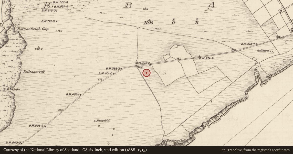
Slide toward Today to fade the historical sheet and see the modern map underneath.
David Rumsey Map Collection, Stanford LibrariesDavid Rumsey Map Collection, Stanford Libraries
2 historical maps cover this location, the earliest the 1753 map "Mappa geographica Regni Hiberniae" (David Rumsey Map Collection, Stanford Libraries).
Historical maps covering this location
- 1753 · Mappa geographica Regni Hiberniae (David Rumsey Map Collection, Stanford Libraries)
- 1841 · Ireland. (David Rumsey Map Collection, Stanford Libraries)
This record in the National Monuments Service's Historic Environment Viewer ↗
The National Monuments Service's description
On the S slope of Bray Head. The W half of this hut site was excavated in 1995-6 (Walsh 1995; Walsh 1996a, 40; Walsh 1996b). Prior to excavation the hut site was visible as a semicircle of vertically set sandstone slabs, which appeared to represent the internal face of a hut site. A mound (H c. 0.3m) had defined the hut site along the S, W and E arcs. Excavation revealed the remains of a circular hut site (diam. 3.2m) defined by an earthen wall (Wth c. 1m) which was internally and externally revetted at the base by large facing-stones set on edge. Two shallow parallel trenches, which were dug into the underlying subsoil, accommodated the inner and outer facing-stones. A large stone-kerbed hearth (L 1.1m; Wth 0.6m; D 0.26m) was located slightly off-centre within the hut site. There was a doorway (max. Wth 1.4m) at the SE side of the hut site, the threshold of which was paved with small flat stones. A flagged pathway led from the doorway and extended to the E beyond the area of excavation. The path overlaid a number of unlined drains. These drains form part of a system which, according to the excavator (Walsh 1996b), appeared to have diverted the water, coming downslope from the N, away from the hut site. A broken whetstone was the sole find from the structure. A number of features, which appear to predate the hut site, were largely obscured by the upstanding structure. Radiocarbon determinations from the occupation levels of the hut site have yielded a date in the late 8th-early 9th century (Walsh 1998, 81). (Walsh 1995; Walsh 1996a, 40; Walsh 1996b; Walsh 1998, 81)
The above description is derived from the published 'Archaeological Inventory of County Kerry. Volume I: South-West Kerry' (Dublin: Stationery Office, 2009). In certain instances the entries have been revised and updated in the light of recent research.
Date of upload: 30 May 2011
Nearby in the register
- Mill - unclassifiedunder 1 mi
- House - medievalunder 1 mi
- House - medievalunder 1 mi
- House - medievalunder 1 mi
Other entries of the same register within about three miles of this one, by straight line.