Sites and Monuments Record · Ireland
Rock art
Letter West, County Kerry, Ireland
The record
- Townland
- Letter West
- County
- Kerry
- Country
- Ireland
- First-edition OS map
- Not Indicated
- Latest-edition OS map
- Not Indicated
- Coordinates
- 52.01001, -10.02748
- SMR number
- KE071-081----
Slide toward Today to fade the historical sheet and see the modern map underneath.
David Rumsey Map Collection, Stanford LibrariesDavid Rumsey Map Collection, Stanford LibrariesDavid Rumsey Map Collection, Stanford LibrariesDavid Rumsey Map Collection, Stanford Libraries
4 historical maps cover this location, the earliest the 1753 map "Mappa geographica Regni Hiberniae" (David Rumsey Map Collection, Stanford Libraries).
Historical maps covering this location
- 1753 · Mappa geographica Regni Hiberniae (David Rumsey Map Collection, Stanford Libraries)
- 1790 · Composite: Ireland. (David Rumsey Map Collection, Stanford Libraries)
- 1869 · Ireland. (David Rumsey Map Collection, Stanford Libraries)
- 1891 · Ireland 16 (David Rumsey Map Collection, Stanford Libraries)
This record in the National Monuments Service's Historic Environment Viewer ↗
The National Monuments Service's description
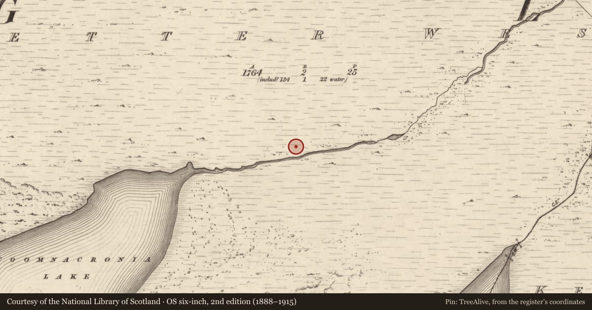
This monument was initially identified as rock art by Aoibheann Lambe in 2014. In mountain heath, on an ENE-facing slope (277m OD), overlooking Behy River valley to NE and glimpse of Coomaglaslaw Lake to SE; overlooked by mountains SE->W->NE. Watercourse (draining from Coomnacronia Lake) is located 20m to SSE and is flanked either side by a deposit of glacial boulders; Rock art site is situated at northern edge. A very smooth and unfractured, sandstone rock (dims. 1.55m NNE-SSW; 3.10m ESE-WNW; max. H 0.60m at E), which has a sub-rectangular decorated surface (dims. 1.35m NNE-SSW; 2.50m ESE-WNW) and a slight NE-facing aspect. Very weathered and faint rock art with lichens covering c. ninety per cent of the surface. The rock art consist of eleven cupmarks (diam. 3-6cm; D 3-4mm) distributed across the central portion of the decorated surface. Seven cup-and-one ring motifs (overall dims. 12-23cm) concentrated across the southern area of decorated surface, having a cupmark (diam. 5-12cm; D 3-4mm) and ring (Wth 2cm; D 2-3mm), three of which are incomplete and three of which have a radial groove extending from the cupmark to the exterior of the motif. Three cup-and-two ring motifs (overall diam. 21-25cm) off-centre to S, having a cupmark (diam. 3.5-5cm; D 4mm) and rings (Wth 1cm; D 2mm) of which the central example is incomplete. Two of these have a radial groove extending from the cupmark to the exterior of the cup-and-three ring motif. One of the single cupmarks mentioned above, is located upon outer ring of cup-and-two ring motif, at W-end of decorated surface. There is a step located on E-edge of this rock, c. 27cm below the decorated surface.
Compiled by: Alison McQueen and Vera Rahilly
Date of upload: 3 March 2017
Nearby in the register
Other entries of the same register within about three miles of this one, by straight line.