Sites and Monuments Record · Ireland
Rock art
Ballynakilly Upper, County Kerry, Ireland
The record
- Townland
- Ballynakilly Upper
- County
- Kerry
- Country
- Ireland
- Coordinates
- 52.01637, -9.96102
- SMR number
- KE071-070----
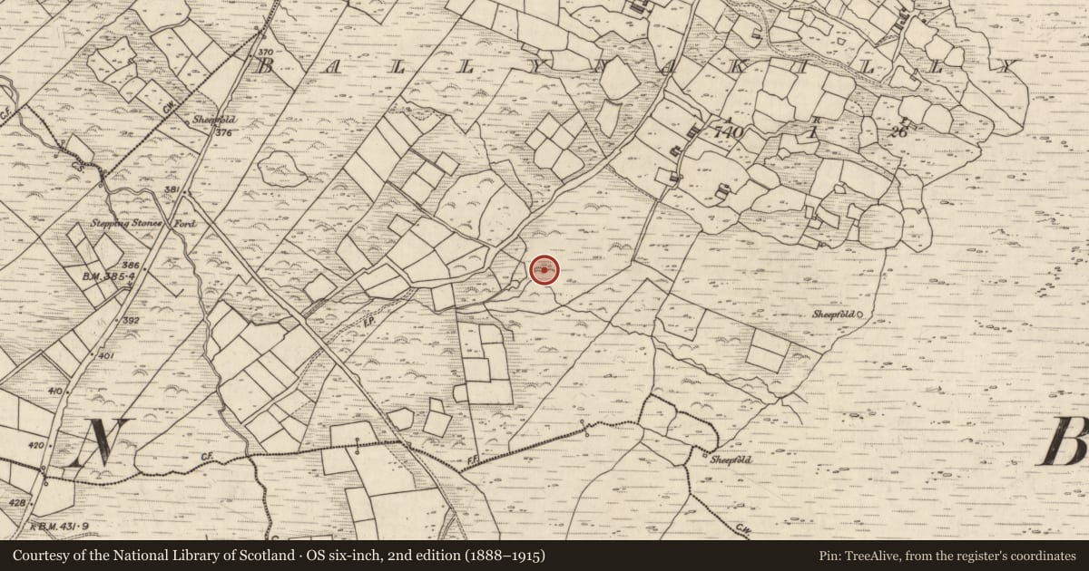
Slide toward Today to fade the historical sheet and see the modern map underneath.
David Rumsey Map Collection, Stanford LibrariesDavid Rumsey Map Collection, Stanford LibrariesDavid Rumsey Map Collection, Stanford LibrariesDavid Rumsey Map Collection, Stanford Libraries
4 historical maps cover this location, the earliest the 1753 map "Mappa geographica Regni Hiberniae" (David Rumsey Map Collection, Stanford Libraries).
Historical maps covering this location
- 1753 · Mappa geographica Regni Hiberniae (David Rumsey Map Collection, Stanford Libraries)
- 1790 · Composite: Ireland. (David Rumsey Map Collection, Stanford Libraries)
- 1869 · Ireland. (David Rumsey Map Collection, Stanford Libraries)
- 1891 · Ireland 16 (David Rumsey Map Collection, Stanford Libraries)
This record in the National Monuments Service's Historic Environment Viewer ↗
The National Monuments Service's description
In centre of improved pasture field, on a NW-facing slope (166m OD). Distant view of Atlantic Ocean to N, between Drung Hill and Droum; Coomasaharn mountains to W. A substantial sandstone boulder (dims. 4.40m NW-SE; 3.50m NE-SW; max. H 1.80m), which has three roughly rectangular decorated surfaces: The main decorated surface (dims. 1.30m NW-SE; 0.50m NE-SW) is located close to ground level at NE-side of NW-facing aspect; the second decorated surface (dims. 0.65m N-S; 0.20m E-W) is on top of the boulder and the third decorated surface (dims. 3.2m N-S; 2.3m E-W) is on the SE-facing aspect. The boulder is slightly rough and fractured and the rock art is weathered yet traceable. The main concentration of motifs are upon the NE-facing aspect and consist of two similar motifs each comprising of a simple cross enclosed by a circular ring at S-side of decorated surface. The western cross-and-ring motif (dims. 15cm N-S; 14cm E-W; D 4mm) is connected to the eastern cross-and-ring motif (dims. 18cm N-S; 15cm E-W; D 4mm) by a linear groove (L14cm; Wth 1cm; D 3-4mm). A second linear groove (L 20cm; D 4mm) links the eastern cross-and-ring motif to a cup-and-two-ring motif, at NW. This cup-and-two-ring motif (diam. 18cm) has a cupmark (diam. 2cm; D 3mm) which is enclosed by a complete inner ring and an incomplete outer ring that is truncated by a linear groove (L 12cm) at W. A penannular ring (dims. 9cm N-S; 8cm E-W; D 4mm) formed by obvious pickmarks and open at S, is located 3cm to N. A number of linear grooves are noted to N and NW of the cup-and-two-ring motif, the longest groove (L 42cm N-S; Wth 3.5cm) is to N. A possible cup-and-ring motif (dims. 10cm NW-SE) is truncated by a linear groove (L 19cm NNW-SSE; Wth 3cm) across the NE-sector. Two cupmarks (diam. 3-4cm; D 4-5mm) are located to NW. A long, meandering groove and possible solution marks are located further to W. It should be noted that some of the linear grooves may be modern as they have a relatively fresh appearance. The top of the boulder is generally level and bears two cup-and-two-ring motifs (aligned N-S). The northern cup-and-two-ring motif (diam. 14cm) has a cupmark (diam . 1.5cm; D 2mm) and rings (Wth 1cm; D 2-3mm). The inner ring is complete and the outer ring is truncated (long-axis N-S) across the W-side by a linear groove (L 15cm N-S; Wth 3cm; D 3mm). The second cup-and-two-ring motif (diam. 16cm) having a cupmark (diam. 2cm; D 4mm) and rings (Wth 1cm; D 3mm) is located 12cm to S. A linear groove (L 19cm N-S; Wth 2cm; D 4mm) extends from 1cm to S of the outer ring. Again, these grooves are possibly modern as they appear fresh. The SE-facing aspect of the boulder also bears rock art in the form of a curvilinear groove (L 2.40m N-S; Wth 3cm; D 4-5mm) situated toward the W-side. A second curvilinear groove (L 0.64m NE-SW; Wth 4cm; D 3mm) is located off 1m to E, at its closet point.
Compiled by: Alison McQueen and Vera Rahilly
Date of upload: 3 March 2017
Nearby in the register
- Fulacht fiaunder 1 mi
- Rock artunder 1 mi
- Rock artunder 1 mi
- Rock artunder 1 mi
Other entries of the same register within about three miles of this one, by straight line.