Sites and Monuments Record · Ireland
Ringfort - rath
Coulagh, County Kerry, Ireland
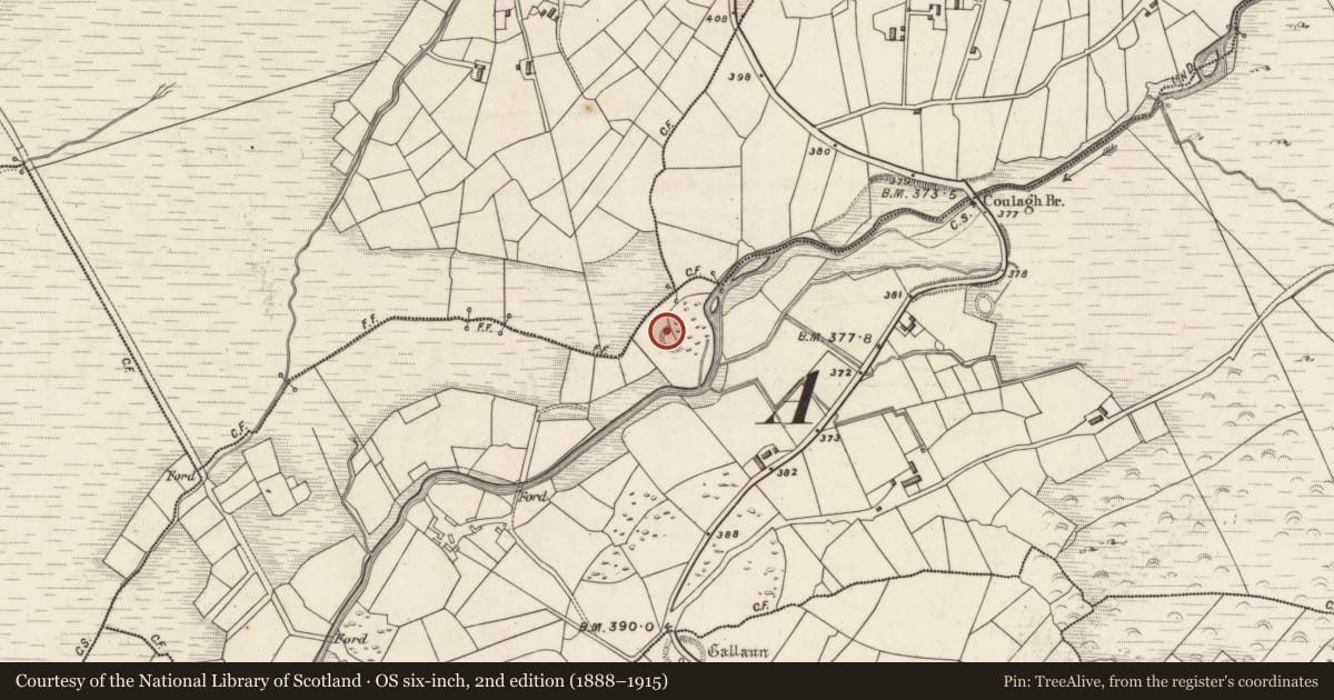
The record
- Townland
- Coulagh
- County
- Kerry
- Country
- Ireland
- Latest-edition OS map
- Hachured
- Coordinates
- 51.98235, -10.08764
- SMR number
- KE070-029----
Slide toward Today to fade the historical sheet and see the modern map underneath.
David Rumsey Map Collection, Stanford LibrariesDavid Rumsey Map Collection, Stanford LibrariesDavid Rumsey Map Collection, Stanford LibrariesDavid Rumsey Map Collection, Stanford Libraries
4 historical maps cover this location, the earliest the 1790 map "Composite: Ireland." (David Rumsey Map Collection, Stanford Libraries).
Historical maps covering this location
- 1790 · Composite: Ireland. (David Rumsey Map Collection, Stanford Libraries)
- 1841 · Ireland. (David Rumsey Map Collection, Stanford Libraries)
- 1869 · Ireland. (David Rumsey Map Collection, Stanford Libraries)
- 1891 · Ireland 16 (David Rumsey Map Collection, Stanford Libraries)
This record in the National Monuments Service's Historic Environment Viewer ↗
The National Monuments Service's description
Internal diam. 27.7m N-S
This univallate rath is located in reclaimed land on the bank of the N tributary of the Ferta river, and commands an impressive view along the river valley to SW. Only the W half of the site is extant and this is best preserved along the N sector. The fosse measures 4.7m wide and .5m deep below external ground level. The bank, of earth and stone, rises to a maximum external height of 3.25m, has a basal width of 3.4m and falls 1.5m internally. Intermittent stretches of drystone walling revet its inner face. At W, where it is 2.3m high, this walling displays a slight batter. However, some of the walling appears to be of recent construction. Trees have been planted in the interior of the site obscuring any possible features. A lintelled lamb shelter abuts the site externally at NE.
The above description is derived from A. O'Sullivan and J. Sheehan (compilers), 'The Iveragh peninsula: an archaeological survey of South Kerry'. Cork University Press (1996), no. 496. In certain instances the entries have been revised and updated in the light of recent research.
Date of upload: 28 July 2013
Nearby in the register
- Hut siteunder 1 mi
- Ringfort - rathunder 1 mi
- Ringfort - rathunder 1 mi
- Enclosureunder 1 mi
Other entries of the same register within about three miles of this one, by straight line.