Sites and Monuments Record · Ireland
Church
Innisfallen, County Kerry, Ireland
The record
- Townland
- Innisfallen
- County
- Kerry
- Country
- Ireland
- First-edition OS map
- Not indicated
- Latest-edition OS map
- Not indicated
- Coordinates
- 52.04627, -9.55468
- SMR number
- KE066-072007-
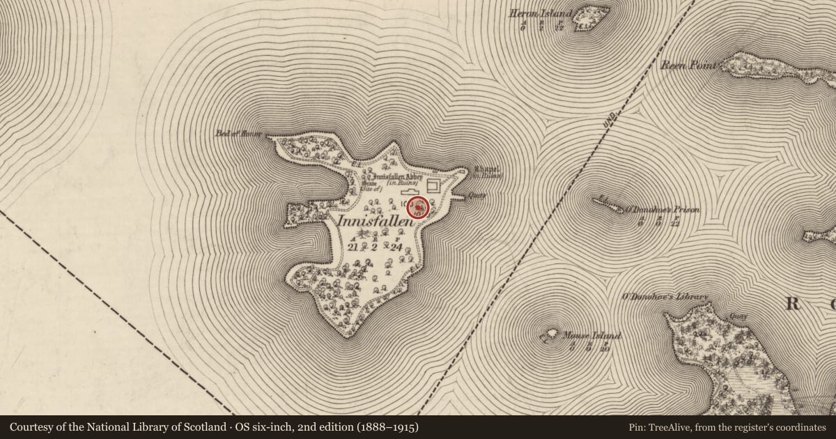
Slide toward Today to fade the historical sheet and see the modern map underneath.
David Rumsey Map Collection, Stanford LibrariesDavid Rumsey Map Collection, Stanford LibrariesDavid Rumsey Map Collection, Stanford LibrariesDavid Rumsey Map Collection, Stanford Libraries
4 historical maps cover this location, the earliest the 1790 map "Composite: Ireland." (David Rumsey Map Collection, Stanford Libraries).
Historical maps covering this location
- 1790 · Composite: Ireland. (David Rumsey Map Collection, Stanford Libraries)
- 1841 · Ireland. (David Rumsey Map Collection, Stanford Libraries)
- 1869 · Ireland. (David Rumsey Map Collection, Stanford Libraries)
- 1891 · Ireland 16 (David Rumsey Map Collection, Stanford Libraries)
This record in the National Monuments Service's Historic Environment Viewer ↗
The National Monuments Service's description
National Monument No. 183. On a hillock close to the SE shoreline, on Innisfallen Island in Lough Leane. A single-cell rectangular oratory (ext. dims. 6.8m x 5m; int. dims. 5.1m x 3.4m) constructed on three limestone plinths (extending c. 0.1-0.2m beyond the foundation courses). The W gable stands to almost its full height (H c. 2.5m), elsewhere the walls stand to a max. H of 1m. The church is constructed of limestone and has undergone some restoration. The W sandstone doorway with plain round arch and well-cut, slightly inclining jambs (H 1.9m; Wth at springers 0.6m; Wth at base 0.65m) is of early Hiberno-Romanesque style; possibly late 11th/early 12th century. The E window does not survive. An altar has been inserted at the E end. The Augustinian Abbey (KE066-072001-) lies a short distance to the N. (Weaver 1995)
M. Weaver 1995 'An architectural survey of Inisfallen Island, Lough Leane, Co. Kerry.' MA Thesis, Dept. of Archaeology, UCC.
Compiled by: Elizabeth Byrne, Ursula Egan and Sheila Ronan, Archaeological Survey Unit, University College, Cork.
Date of upload: 31 January 2011
Nearby in the register
- Graveslabunder 1 mi
- Churchunder 1 mi
- Bullaun stoneunder 1 mi
- Ecclesiastical siteunder 1 mi
Other entries of the same register within about three miles of this one, by straight line.