Sites and Monuments Record · Ireland
Rock art
Ballykissane, County Kerry, Ireland
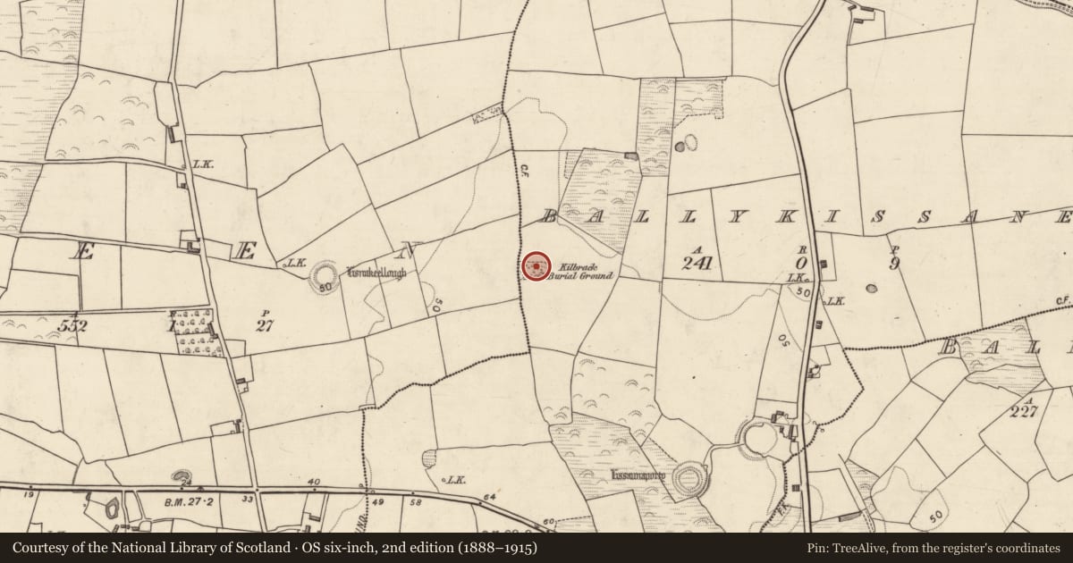
The record
- Townland
- Ballykissane
- County
- Kerry
- Country
- Ireland
- Coordinates
- 52.12084, -9.79294
- SMR number
- KE056-009002-
Slide toward Today to fade the historical sheet and see the modern map underneath.
David Rumsey Map Collection, Stanford LibrariesDavid Rumsey Map Collection, Stanford LibrariesDavid Rumsey Map Collection, Stanford LibrariesDavid Rumsey Map Collection, Stanford Libraries
4 historical maps cover this location, the earliest the 1753 map "Mappa geographica Regni Hiberniae" (David Rumsey Map Collection, Stanford Libraries).
Historical maps covering this location
- 1753 · Mappa geographica Regni Hiberniae (David Rumsey Map Collection, Stanford Libraries)
- 1790 · Composite: Ireland. (David Rumsey Map Collection, Stanford Libraries)
- 1869 · Ireland. (David Rumsey Map Collection, Stanford Libraries)
- 1891 · Ireland 16 (David Rumsey Map Collection, Stanford Libraries)
This record in the National Monuments Service's Historic Environment Viewer ↗
The National Monuments Service's description
In improved pasture (21m OD), on a low rise, within children’s burial ground (KE056-009----) known as ‘Kilbrack Burial Ground’. Glimpse of Castlemaine Harbour to N and excellent views along Slieve Mish and other mountains of the Dingle Peninsula to W. Situated beneath a whitethorn tree at N side of burial ground and possibly ex-situ. A smooth and fractured, loose boulder (dims. 1.08m NNE-SSW; 0.84m ESE-WNW; max. T 0.22m) propped upon a single stone and having a thin, horizontal fracture (long-axis ENE-WSW) across its upper surface. It has a subrectangular decorated surface (dims. 1.08m NNE-SSW; 0.84m ESE-WNW) bearing sixteen decorative elements which are in good condition. These consist of a large cup-and-ring motif (overall diam. 18cm; ring Wth 2-2.5cm; D 2-3cm; cup diam. 8cm; D 20mm) at NE end of decorated surface. Two other cup-and-ring motifs are adjacent to SW. A composite element (overall dims. 32cm x 24cm) comprising of a cup-and-ring motif and a cupmark enclosed by a partial ring, is located toward SW area of decorated surface. Twelve cupmarks (range diam. 5-9cm; D 5-14mm) are distributed across the surface.
Compiled by: Alison McQueen and Vera Rahilly
Date of upload: 6 July 2017
Nearby in the register
- Children's burial groundunder 1 mi
- Buildingunder 1 mi
- Ringfort - rathunder 1 mi
- Ringfort - rathunder 1 mi
Other entries of the same register within about three miles of this one, by straight line.