Sites and Monuments Record · Ireland
Rock art
Knockbrack (Magunihy By.), County Kerry, Ireland
The record
- Townland
- Knockbrack (Magunihy By.)
- County
- Kerry
- Country
- Ireland
- Coordinates
- 52.19723, -9.64851
- SMR number
- KE047-105002-
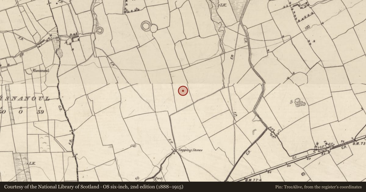
Slide toward Today to fade the historical sheet and see the modern map underneath.
David Rumsey Map Collection, Stanford LibrariesDavid Rumsey Map Collection, Stanford LibrariesDavid Rumsey Map Collection, Stanford LibrariesDavid Rumsey Map Collection, Stanford Libraries
4 historical maps cover this location, the earliest the 1790 map "Composite: Ireland." (David Rumsey Map Collection, Stanford Libraries).
Historical maps covering this location
- 1790 · Composite: Ireland. (David Rumsey Map Collection, Stanford Libraries)
- 1841 · Ireland. (David Rumsey Map Collection, Stanford Libraries)
- 1869 · Ireland. (David Rumsey Map Collection, Stanford Libraries)
- 1891 · Ireland 16 (David Rumsey Map Collection, Stanford Libraries)
This record in the National Monuments Service's Historic Environment Viewer ↗
The National Monuments Service's description
In improved pasture (21m OD), upon a low lying area, at base of a S-facing slope; Stream is c. 75m to S. In valley of River Maine with excellent views of Gap of Dunloe to S and MacGillycuddy’s Reeks to SW. A smooth and fractured sandstone (dims. 3.6m E-W; 1.2m N-S) which is irregular in plan and is just above the existing ground level. It has a subrectangular decorated surface (dims. 1.55m E-W; 0.7m N-S) which is generally flat with a very slight N-facing tilt. The motifs are in a reasonably good condition and consist of a number of decorative elements. There are at least fourteen cupmarks (5-6cm; Dth 4-5mm) distributed across the stone. There are three cup-and-one ring motifs: The smallest cup-and-ring motif (overall dims. 14cm x 11cm; cup diam. 4.5cm; D 3mm; ring Wth 2-2.5cm; D 2mm) and the largest cup-and-ring motif (overall dims. 20cm x 18cm; cup diam. 5cm; D 4mm; ring Wth 2cm; D 2mm). Possibly a very faint outline of a fourth, larger cup-and-ring motif adjacent to W. Rock art (KE047-105----) is c. 2.6m to S.
To see a 3D model of this monument, visit; https://skfb.ly/oyoXR
Compiled by: Alison McQueen and Vera Rahilly
Date of upload: 17 July 2017
Nearby in the register
- Rock artunder 1 mi
- Ogham stoneunder 1 mi
- Standing stoneunder 1 mi
- Ringfort - rathunder 1 mi
Other entries of the same register within about three miles of this one, by straight line.