Sites and Monuments Record · Ireland
Children's burial ground
Gort Na Gcuileannach, County Kerry, Ireland
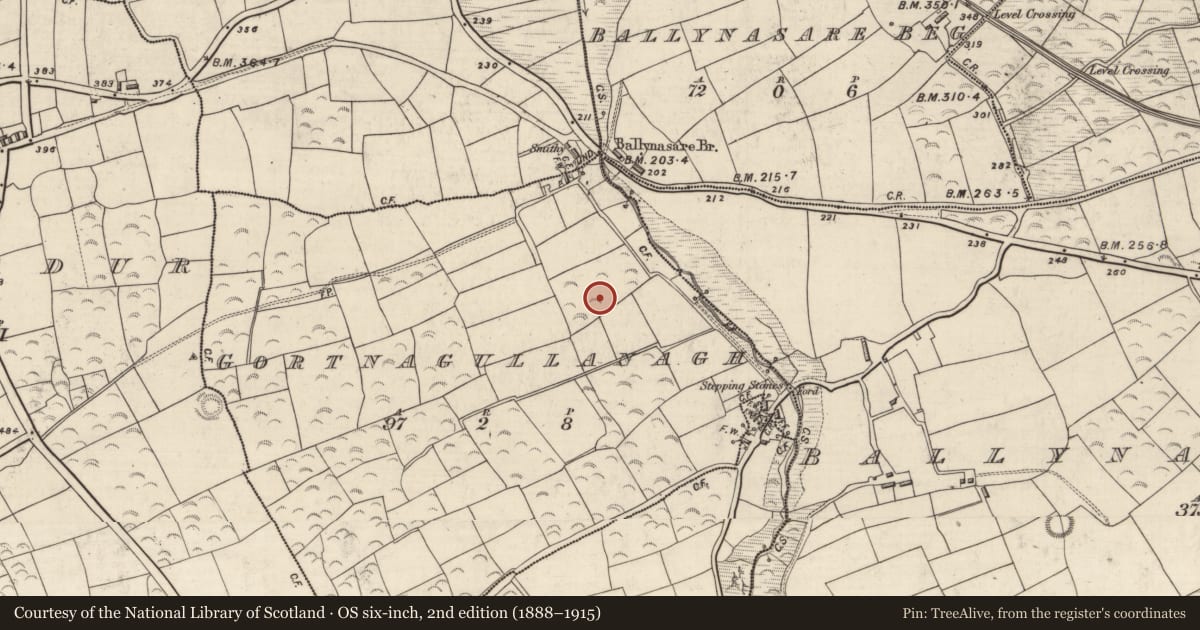
The record
- Townland
- Gort Na Gcuileannach
- County
- Kerry
- Country
- Ireland
- First-edition OS map
- Dotted outline
- Latest-edition OS map
- Not indicated
- Coordinates
- 52.14217, -10.12379
- SMR number
- KE044-094004-
Slide toward Today to fade the historical sheet and see the modern map underneath.
David Rumsey Map Collection, Stanford LibrariesDavid Rumsey Map Collection, Stanford LibrariesDavid Rumsey Map Collection, Stanford LibrariesDavid Rumsey Map Collection, Stanford Libraries
4 historical maps cover this location, the earliest the 1790 map "Composite: Ireland." (David Rumsey Map Collection, Stanford Libraries).
Historical maps covering this location
- 1790 · Composite: Ireland. (David Rumsey Map Collection, Stanford Libraries)
- 1841 · Ireland. (David Rumsey Map Collection, Stanford Libraries)
- 1869 · Ireland. (David Rumsey Map Collection, Stanford Libraries)
- 1891 · Ireland 16 (David Rumsey Map Collection, Stanford Libraries)
This record in the National Monuments Service's Historic Environment Viewer ↗
The National Monuments Service's description
Children's burial ground described by Cuppage (1986, 226, no. 699) as follows; 'This site was marked on the 1st edition of the OS map as a circular ring of dots. It is known locally as a fort and was identified by Hitchcock (1853, 401-3) as a rath. The field in which it is located is named 'Páirc an Leasa'. A cross-inscribed ogham stone [KE044-094002-] formerly acted as a lintel over the doorway to a D-shaped clochaun [KE044-094001-] which stood within the enclosure. This was removed by Hitchcock and presented to the Royal Irish Academy, along with a quernstone also found at the site. The ogham stone is now preserved in the NMI.
Ringfort [KE044-094----]: The site is severely disturbed and has been used as a quarry for road metal. Its E half is now occupied by an amorphous group of pits and mounds, but a curving bank of earth and stone can be traced around the W half of the site. The area covered by these features measures 23.5m N-S and 23m E-W. Windele (1848, 468-70) was locally informed that the site had been used as a burial ground for children but not within living memory. Some quartz stones scattered about the site today could have been introduced to mark burials'.
Compiled by: Caimin O'Brien
Date of upload: 7 April 2022
References
Cuppage, J. 1986 Corca Dhuibhne. Dingle Peninsula archaeological survey. Ballyferriter. Oidhreacht Chorca Dhuibhne.
Windele, J. 1848 Excursions in Kerry. Royal Irish Academy MS 12 C 11.
Hitchcock, R. 1848 An Account of the Discovery of Ogham Stones presented by Mr. Richard Hitchcock. Proceedings of the Royal Irish Academy 4, 271-272.
Hitchcock, R. 1850 Extract from letter quoted in Transactions of the Kilkenny Archaeological Society 1, 140-141.
Hitchcock, R. 1853 Letter quoted in Proceedings of the Royal Irish Academy 5, 401-403.
Nearby in the register
- Ringfort - rathunder 1 mi
- Clochanunder 1 mi
- Ogham stoneunder 1 mi
- Fulacht fiaunder 1 mi
Other entries of the same register within about three miles of this one, by straight line.