Sites and Monuments Record · Ireland
Barrow - unclassified
Annagh (Trughanacmy By., Kiltallagh ED), County Kerry, Ireland
The record
- Townland
- Annagh (Trughanacmy By., Kiltallagh ED)
- County
- Kerry
- Country
- Ireland
- Coordinates
- 52.24877, -9.75220
- SMR number
- KE038-138----
Slide toward Today to fade the historical sheet and see the modern map underneath.
David Rumsey Map Collection, Stanford LibrariesDavid Rumsey Map Collection, Stanford LibrariesDavid Rumsey Map Collection, Stanford LibrariesDavid Rumsey Map Collection, Stanford Libraries
4 historical maps cover this location, the earliest the 1753 map "Mappa geographica Regni Hiberniae" (David Rumsey Map Collection, Stanford Libraries).
Historical maps covering this location
- 1753 · Mappa geographica Regni Hiberniae (David Rumsey Map Collection, Stanford Libraries)
- 1790 · Composite: Ireland. (David Rumsey Map Collection, Stanford Libraries)
- 1869 · Ireland. (David Rumsey Map Collection, Stanford Libraries)
- 1891 · Ireland 16 (David Rumsey Map Collection, Stanford Libraries)
This record in the National Monuments Service's Historic Environment Viewer ↗
The National Monuments Service's description
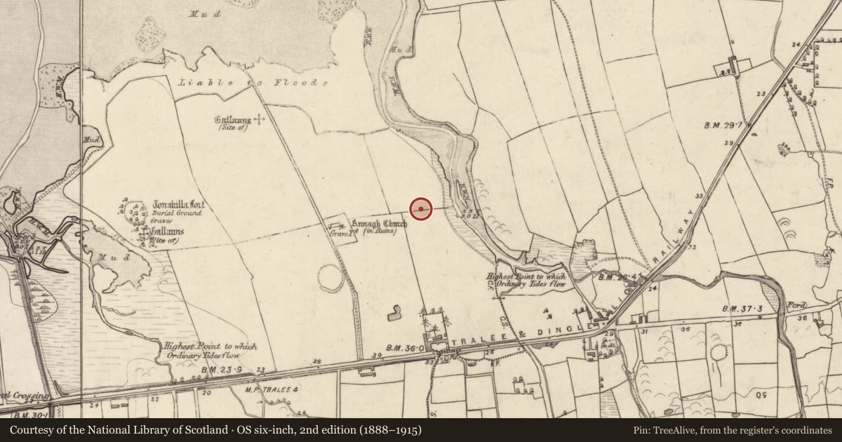
'The land is quite marshy and wet and is used as rough grazing for cattle at the moment. Several low banks of earth and stone also occur in this complex, but, as yet, their relationship to the barrows is unknown. Located on the west bank of a small river which is prone to flooding, c.200m from the coast in an area of marshy grassland...... this low mound is located on the immediate SE side of the barrow [KE038-137----]. This mound measures 9.50m N-S by 11.50m E-W at base and is 1.75m high. It is constructed of a mixture of earth and stones, and narrows slightly towards the top. A hollow occurs at the crest of the mound, 3.40m N-S by 4.0m E-W and is 0.50m below the top of the mound. This hollow may be the result of relatively modern interference. An opening occurs at east, 1.00m wide, but again probably represents the result of this interference. This mound is situated c.15m to the west of the river.'
Compiled by Michael Connolly for the Archaeological Survey of Ireland as part of a survey of the Lee Valley area in 1996-97.
Date of upload: 30 April 2012
Nearby in the register
- Barrow - unclassifiedunder 1 mi
- Barrow - unclassifiedunder 1 mi
- Barrow - ring-barrowunder 1 mi
- Enclosureunder 1 mi
Other entries of the same register within about three miles of this one, by straight line.