Sites and Monuments Record · Ireland
Graveyard
Ballymore Eustace East (Ballymore Eustace ED), County Kildare, Ireland
The record
- Townland
- Ballymore Eustace East (Ballymore Eustace ED)
- County
- Kildare
- Country
- Ireland
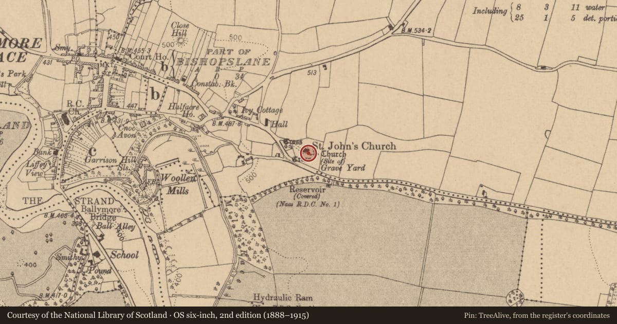
- First-edition OS map
- Grave Yard
- Latest-edition OS map
- Indicated
- Coordinates
- 53.13141, -6.60634
- SMR number
- KD029-011004-
Slide toward Today to fade the historical sheet and see the modern map underneath.
David Rumsey Map Collection, Stanford LibrariesDavid Rumsey Map Collection, Stanford LibrariesDavid Rumsey Map Collection, Stanford LibrariesDavid Rumsey Map Collection, Stanford Libraries
4 historical maps cover this location, the earliest the 1790 map "Composite: Ireland." (David Rumsey Map Collection, Stanford Libraries).
Historical maps covering this location
- 1790 · Composite: Ireland. (David Rumsey Map Collection, Stanford Libraries)
- 1799 · Ireland. (David Rumsey Map Collection, Stanford Libraries)
- 1830 · V.3:11-15:XV. Britisches Reich. C. Kon: Ireland. a. Prov: Leinster. Counties: 1-12 (David Rumsey Map Collection, Stanford Libraries)
- 1891 · Ireland 16 (David Rumsey Map Collection, Stanford Libraries)
This record in the National Monuments Service's Historic Environment Viewer ↗
The National Monuments Service's description
On a S-facing slope on the E edge of Ballymore Eustace, a historic town (KD029-011001-). A roughly square area (max. c. 82m E-W; c. 80m N-S) is enclosed by a well-built stone wall with a gate and stile in the NW corner and a gate in the SE corner. Mature beech and yew trees grow throughout. It’s likely to have been a significant pre-Norman ecclesiastical site because the graveyard also contains two high crosses (KD029-011006- and KD029-011007-), two cross-inscribed slabs (KD029-011008-, KD029-011009-) and seven graveslabs (KD029-011014- to KD029-011020-). There is also a medieval font (KD029-011013-), a holed stone (KD029-011012-) and the fragmentary remains of a medieval church (KD029-011002-) to the rear of an upstanding 19th-century church, which itself contains a second medieval font (KD029-011013-) and a 16th-century knightly effigy (KD029-011011-). Burials from the 18th-century to recent times are marked by chest tombs, table tombs and headstones, many of which are leaning and some of which are broken.
Compiled by: Gearóid Conroy
Date of upload: 30 August 2013
Nearby in the register
- Tomb - effigial (present location)under 1 mi
- Graveslabunder 1 mi
- Churchunder 1 mi
- Fontunder 1 mi
Other entries of the same register within about three miles of this one, by straight line.