Sites and Monuments Record · Ireland
Church
Nurney (Nurney ED), County Kildare, Ireland
The record
- Townland
- Nurney (Nurney ED)
- County
- Kildare
- Country
- Ireland
- First-edition OS map
- Church
- Latest-edition OS map
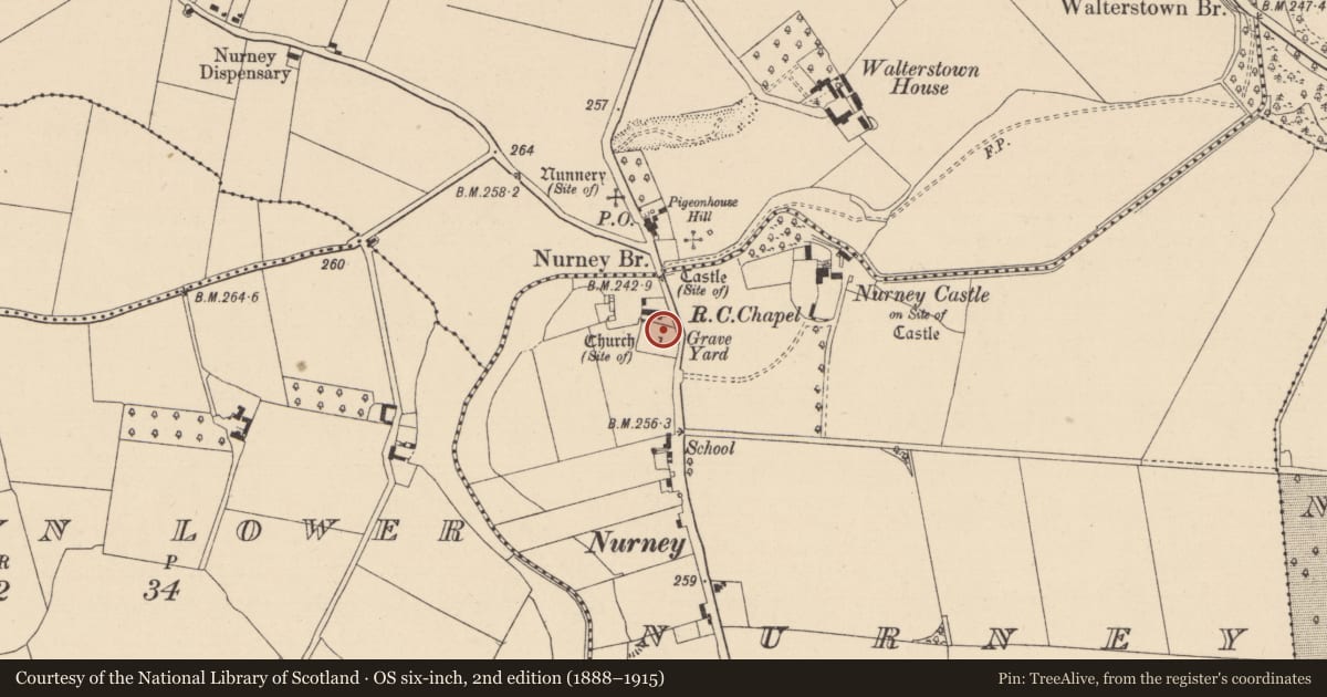
- Church (Site of)
- Coordinates
- 53.09593, -6.94828
- SMR number
- KD027-027----
Slide toward Today to fade the historical sheet and see the modern map underneath.
David Rumsey Map Collection, Stanford LibrariesDavid Rumsey Map Collection, Stanford LibrariesDavid Rumsey Map Collection, Stanford LibrariesDavid Rumsey Map Collection, Stanford Libraries
4 historical maps cover this location, the earliest the 1790 map "Composite: Ireland." (David Rumsey Map Collection, Stanford Libraries).
Historical maps covering this location
- 1790 · Composite: Ireland. (David Rumsey Map Collection, Stanford Libraries)
- 1799 · Ireland. (David Rumsey Map Collection, Stanford Libraries)
- 1830 · V.3:11-15:XV. Britisches Reich. C. Kon: Ireland. a. Prov: Leinster. Counties: 1-12 (David Rumsey Map Collection, Stanford Libraries)
- 1891 · Ireland 16 (David Rumsey Map Collection, Stanford Libraries)
This record in the National Monuments Service's Historic Environment Viewer ↗
The National Monuments Service's description
In a graveyard (KD027-027001-). The very poorly preserved and totally ivy-clad remains of a rectangular structure (c. 15m E-W; 6m N-S) comprising an E gable wall and short portions of the N and S sidewalls constructed of roughly coursed, mortared limestone boulders. The W-end is defined by a pronounced scarp (H 1.2m) over the exterior. There are two narrow inward-splaying lights in the E-gable wall. In 2002, archaeological test-trenching (Excavation Licence no. 02E1126) was carried out at the site of a proposed housing development immediately S and W of the church and graveyard. ‘Trench 2’ at the far south of the development revealed evidence of a possible curvilinear ditch on the surface of which a sherd of local, unglazed, medieval cooking ware was found. ‘Trench 3’ at the E of the development revealed a series of eight parallel, N-S furrows. Medieval pottery was found at the base of two of the furrows, suggesting that this may have been part of a medieval field system.
(http://www.excavations.ie/Pages/Details.php?Year=&County=Kildare&id=8317 Accessed 10-09-2012)
Compiled by: Gearóid Conroy
Date of upload: 10 October 2012
Nearby in the register
- Graveyardunder 1 mi
- Castle - unclassifiedunder 1 mi
- Religious house - unclassifiedunder 1 mi
- Graveyardunder 1 mi
Other entries of the same register within about three miles of this one, by straight line.