Sites and Monuments Record · Ireland
Graveyard
Kilteel Upper, County Kildare, Ireland
The record
- Townland
- Kilteel Upper
- County
- Kildare
- Country
- Ireland
- First-edition OS map
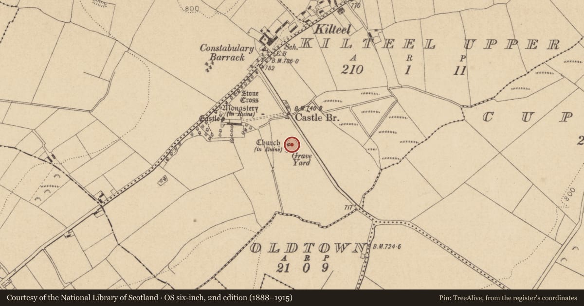
- Grave Yd
- Latest-edition OS map
- Grave Yard
- Coordinates
- 53.23186, -6.52439
- SMR number
- KD020-007010-
Slide toward Today to fade the historical sheet and see the modern map underneath.
David Rumsey Map Collection, Stanford LibrariesDavid Rumsey Map Collection, Stanford LibrariesDavid Rumsey Map Collection, Stanford LibrariesDavid Rumsey Map Collection, Stanford Libraries
4 historical maps cover this location, the earliest the 1799 map "Ireland." (David Rumsey Map Collection, Stanford Libraries).
Historical maps covering this location
- 1799 · Ireland. (David Rumsey Map Collection, Stanford Libraries)
- 1811 · Ireland. (David Rumsey Map Collection, Stanford Libraries)
- 1830 · V.3:11-15:XV. Britisches Reich. C. Kon: Ireland. a. Prov: Leinster. Counties: 1-12 (David Rumsey Map Collection, Stanford Libraries)
- 1891 · Ireland 16 (David Rumsey Map Collection, Stanford Libraries)
This record in the National Monuments Service's Historic Environment Viewer ↗
The National Monuments Service's description
In a minor valley through which a small stream formerly flowed SW just to the N, and on the site of the early monastic foundation of 'Cell céli críst', where a preceptory of Knights Hospitallers (KD020-007003-) was subsequently founded. Contains the ruins of a church (KD020-007002-) which, upon excavation (Manning 1982, 173-229), was found to be the result of several building-phases dating from the Early Christian through the Romanesque and high medieval periods to the 17th c. A section of the Pale Boundary (KD020-008----) runs nearby, to the S and W. A roughly rectangular area (dims. L c. 40m NE-SW; Wth c. 35m NW-SE) is enclosed by a stone wall. Manning (op cit 213-16) identified 23 headstones, one recumbent stone and an iron cross, and recorded all legible inscriptions. The dates on the headstones ranged from 1714 to 1954.
Compiled by: Gearóid Conroy
Date of upload: 10 June 2011
References
Manning, C. 1981-2 Excavation at Kilteel Church, Co. Kildare. Journal of the County Kildare Archaeological Society 16, 173-229.
Nearby in the register
- Cross-inscribed stone (present location)under 1 mi
- Churchunder 1 mi
- Cross-slabunder 1 mi
- Graveslabunder 1 mi
Other entries of the same register within about three miles of this one, by straight line.