Sites and Monuments Record · Ireland
Ogham stone
Donaghmore, County Kildare, Ireland
The record
- Townland
- Donaghmore
- County
- Kildare
- Country
- Ireland
- First-edition OS map
- Not indicated
- Latest-edition OS map
- Not indicated
- Coordinates
- 53.37698, -6.55315
- SMR number
- KD006-005002-
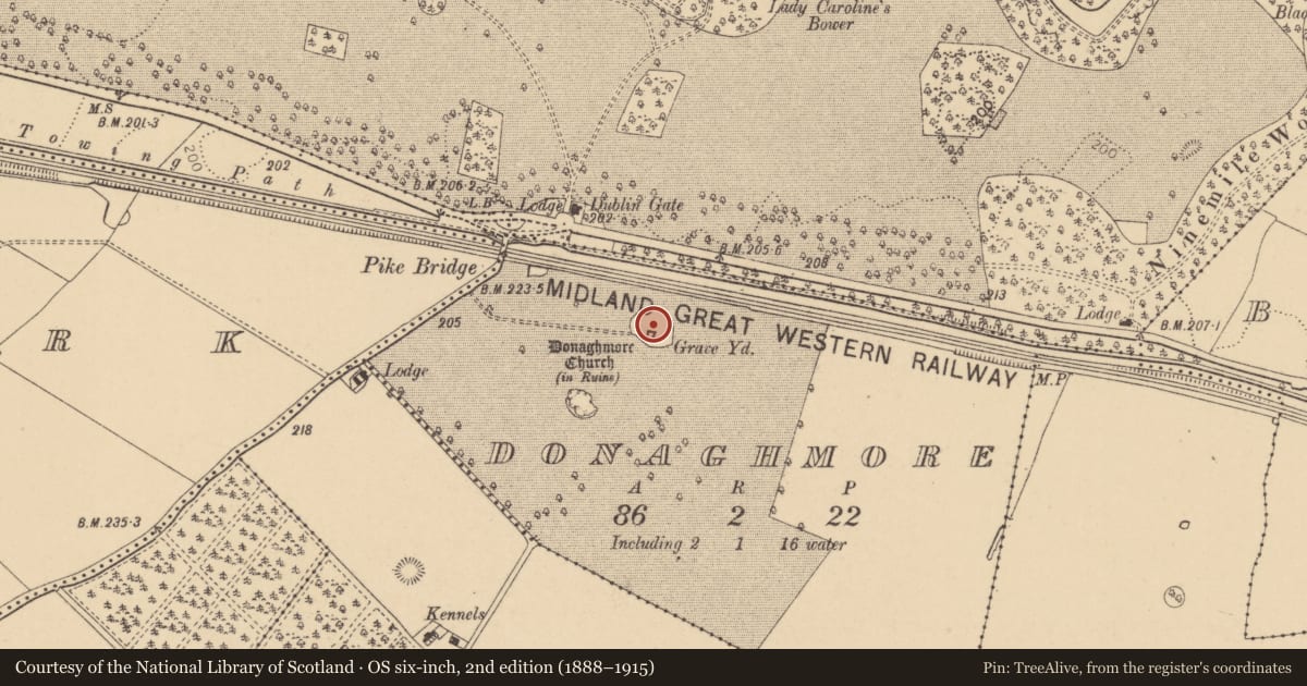
Slide toward Today to fade the historical sheet and see the modern map underneath.
David Rumsey Map Collection, Stanford LibrariesDavid Rumsey Map Collection, Stanford LibrariesDavid Rumsey Map Collection, Stanford LibrariesDavid Rumsey Map Collection, Stanford Libraries
4 historical maps cover this location, the earliest the 1799 map "Ireland." (David Rumsey Map Collection, Stanford Libraries).
Historical maps covering this location
- 1799 · Ireland. (David Rumsey Map Collection, Stanford Libraries)
- 1811 · Ireland. (David Rumsey Map Collection, Stanford Libraries)
- 1830 · V.3:11-15:XV. Britisches Reich. C. Kon: Ireland. a. Prov: Leinster. Counties: 1-12 (David Rumsey Map Collection, Stanford Libraries)
- 1891 · Ireland 16 (David Rumsey Map Collection, Stanford Libraries)
This record in the National Monuments Service's Historic Environment Viewer ↗
The National Monuments Service's description
Discovered in 1902 by Lord Walter Fitzgerald (1903-5, 26) in the NE sector of Donaghmore graveyard (KD006-005004-), where, according to O'Hanluain (1935-45, 170), it marked an O'Farrell family grave. Macalister (1945, 130-1, no. 26) recorded the stone's dimensions (0.76 x 0.36 x 0.23m, converted from Macalister) and read the inscription as: NETTAVRECC [KOI] MAQI MUCCOI TRENALUGGO. McManus (1997, 66, 79) suggested that there was enough room for a more likely NETTAVROICC or NETTAVROECC and that Macalister's KOI was doubtful. The stone is now in the National Museum of Ireland (DU018-173----).
Compiled by: Nora White
Date of upload: 14 September 2016
References
Macalister, R.A.S. 1945 Corpus inscriptionum insularum celticarum. Dublin. Stationery Office.
McManus, D. 1991 A guide to ogam. Maynooth: Monographs 4. Maynooth. An Sagart.
FitzGerald, W. 1902 Discovery of an Ogham Stone near Maynooth, Co. Kildare. Journal of the Royal Society of Antiquaries of Ireland 32, 267-8.
FitzGerald, Lord W. 1903-5 Notes on an Ogham-inscribed stone recently discovered in the Donaghmore Churchyard, near Maynooth, in the County Kildare, with a reading of its inscription by Professor John Rhys. Journal of the Kildare Archaeological Society 4, 155-60.
Rhys, J. 1903 Notes on the ogam-inscribed stones of Donaghmore, Co. Kildare, and Inisvickillane, Co. Kerry. Journal of the Royal Society of Antiquaries of Ireland 33, 75-9.
Nearby in the register
- Ecclesiastical enclosureunder 1 mi
- Graveyardunder 1 mi
- Churchunder 1 mi
- Enclosureunder 1 mi
Other entries of the same register within about three miles of this one, by straight line.