Sites and Monuments Record · Ireland
Cross - Market cross
Kilcock, County Kildare, Ireland
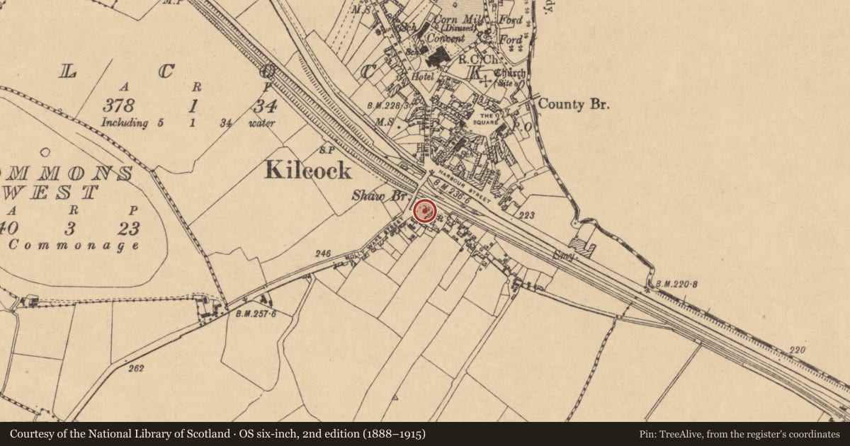
The record
- Townland
- Kilcock
- County
- Kildare
- Country
- Ireland
- First-edition OS map
- Not indicated
- Latest-edition OS map
- Not indicated
- Coordinates
- 53.39866, -6.66893
- SMR number
- KD005-030----
Slide toward Today to fade the historical sheet and see the modern map underneath.
David Rumsey Map Collection, Stanford LibrariesDavid Rumsey Map Collection, Stanford LibrariesDavid Rumsey Map Collection, Stanford LibrariesDavid Rumsey Map Collection, Stanford Libraries
4 historical maps cover this location, the earliest the 1790 map "Composite: Ireland." (David Rumsey Map Collection, Stanford Libraries).
Historical maps covering this location
- 1790 · Composite: Ireland. (David Rumsey Map Collection, Stanford Libraries)
- 1799 · Ireland. (David Rumsey Map Collection, Stanford Libraries)
- 1830 · V.3:11-15:XV. Britisches Reich. C. Kon: Ireland. a. Prov: Leinster. Counties: 1-12 (David Rumsey Map Collection, Stanford Libraries)
- 1891 · Ireland 16 (David Rumsey Map Collection, Stanford Libraries)
This record in the National Monuments Service's Historic Environment Viewer ↗
The National Monuments Service's description
At the W end of the 'Fair Green' to the S of Kilcock village. Rochfort (1999, 74) provides a photograph and brief details on what is regarded locally as being the Kilcock market cross. The photograph shows a small, rectangular, granite (?) cross base with a broad mortice in its upper surface. Traditionally used as a coffin-resting stone.
Compiled by: Gearóid Conroy
Date of upload: 10 June 2011
Nearby in the register
- Coffin-resting stoneunder 1 mi
- Churchunder 1 mi
- Ritual site - holy wellunder 1 mi
- Ecclesiastical siteunder 1 mi
Other entries of the same register within about three miles of this one, by straight line.