Sites and Monuments Record · Ireland
Church
Kilcock, County Kildare, Ireland
The record
- Townland
- Kilcock
- County
- Kildare
- Country
- Ireland
- First-edition OS map
- Church
- Latest-edition OS map
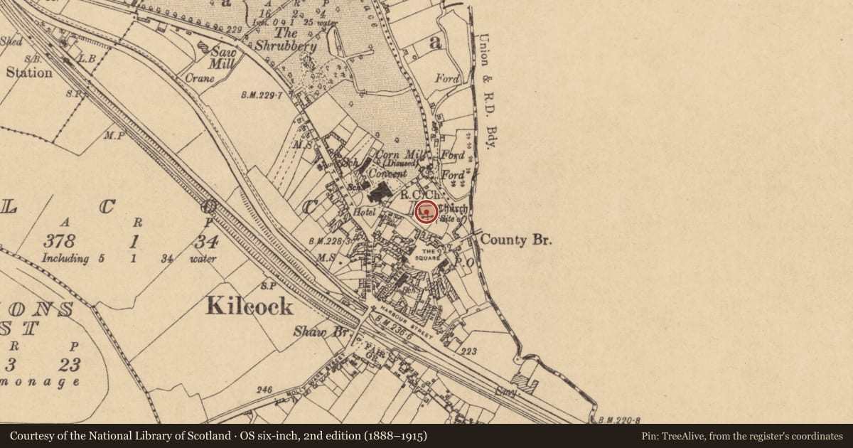
- Church (Site of)
- Coordinates
- 53.40109, -6.66714
- SMR number
- KD005-002001-
Slide toward Today to fade the historical sheet and see the modern map underneath.
David Rumsey Map Collection, Stanford LibrariesDavid Rumsey Map Collection, Stanford LibrariesDavid Rumsey Map Collection, Stanford LibrariesDavid Rumsey Map Collection, Stanford Libraries
4 historical maps cover this location, the earliest the 1790 map "Composite: Ireland." (David Rumsey Map Collection, Stanford Libraries).
Historical maps covering this location
- 1790 · Composite: Ireland. (David Rumsey Map Collection, Stanford Libraries)
- 1799 · Ireland. (David Rumsey Map Collection, Stanford Libraries)
- 1830 · V.3:11-15:XV. Britisches Reich. C. Kon: Ireland. a. Prov: Leinster. Counties: 1-12 (David Rumsey Map Collection, Stanford Libraries)
- 1891 · Ireland 16 (David Rumsey Map Collection, Stanford Libraries)
This record in the National Monuments Service's Historic Environment Viewer ↗
The National Monuments Service's description
According to Cullen (1999, 36) this may have been the church mentioned in 1303 in an Ecclesiastical Commissioners Report as being capable of accommodating 90 people, and which may have been given into the control of the Knight's Hospitallers. Located to NE of centre in a graveyard (KD005-002002-). Known locally as 'St Coca's Church', it may occupy the site of a 6thC monastery (KD005-002----). Traces of the levelled church may survive as a slightly raised, rectangular area (dims L c. 18m E-W; Wth c. 6m; H 0.2-0.5m), at the NE edge of which a short length of walling (traceable L c. 3m; Wth 0.65m) composed of small blocks of mortared stone, projects through the sod cover. This may have been original location of the decorated medieval font (KD005-029----) now located in the nearby 'St Patrick's', 19th century Catholic church. The 1st ed. (1838) OS 6-inch map representation of a roofed church in the S corner of the graveyard may be a cartographic error?
Compiled by: Gearóid Conroy
Date of upload: 10 June 2011
Nearby in the register
- Ecclesiastical siteunder 1 mi
- Graveyardunder 1 mi
- Children's burial groundunder 1 mi
- Coffin-resting stoneunder 1 mi
Other entries of the same register within about three miles of this one, by straight line.