Sites and Monuments Record · Ireland
Castle - tower house
Clonagh (Cadamstown ED), County Kildare, Ireland
The record
- Townland
- Clonagh (Cadamstown ED)
- County
- Kildare
- Country
- Ireland
- First-edition OS map
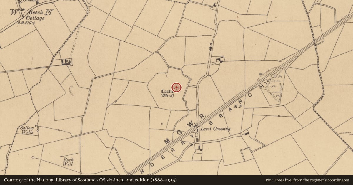
- Site of Castle
- Latest-edition OS map
- Castle (Site of)
- Coordinates
- 53.39623, -6.91078
- SMR number
- KD003-017----
Slide toward Today to fade the historical sheet and see the modern map underneath.
David Rumsey Map Collection, Stanford LibrariesDavid Rumsey Map Collection, Stanford LibrariesDavid Rumsey Map Collection, Stanford LibrariesDavid Rumsey Map Collection, Stanford Libraries
4 historical maps cover this location, the earliest the 1790 map "Composite: Ireland." (David Rumsey Map Collection, Stanford Libraries).
Historical maps covering this location
- 1790 · Composite: Ireland. (David Rumsey Map Collection, Stanford Libraries)
- 1799 · Ireland. (David Rumsey Map Collection, Stanford Libraries)
- 1830 · V.3:11-15:XV. Britisches Reich. C. Kon: Ireland. a. Prov: Leinster. Counties: 1-12 (David Rumsey Map Collection, Stanford Libraries)
- 1891 · Ireland 16 (David Rumsey Map Collection, Stanford Libraries)
This record in the National Monuments Service's Historic Environment Viewer ↗
The National Monuments Service's description
According to O'Leary (1896-99, 135-38) a date stone (KD003-017001-) attests that a castle was built by John Lye in 1578. O'Leary also notes the presence of a 'religious house' (KD003-020----), 'burial place' (KD003-020001-) and stone cross (KD003-02002--) in this area and quotes from a 1608 Inquisition held at Naas that, '… John Lye of Rathbride, gent., being seized of divers lands in the said townland of Clonaugh, levelled the tenements, bounds, and limits of said religious house, threw down and destroyed the cross and trees and erected a tower, or small castle, with other buildings.' Also, according to O'Leary (1904, 172-3) stones from the demolished Clonagh Castle were used to build 'Kilshanchoe Church' (KD003-027----).
On a very slight rise c. 50m to the W of a small N-flowing stream in open pastureland. In 1985 there were no visible surface traces of the monument (SMR file). Two armorial plaques (KD004-002----) incorporated into the walls of a primary school in Johnstown village and an architectural fragment (KD004-003----) incorporated into a modern wall in the village are said to have come from the castle.
Compiled by: Gearóid Conroy
Date of upload: 10 June 2011
Nearby in the register
- Armorial plaqueunder 1 mi
- Architectural fragmentunder 1 mi
- Enclosureunder 1 mi
- Crossunder 1 mi
Other entries of the same register within about three miles of this one, by straight line.