Sites and Monuments Record · Ireland
Leacht
Eoghanacht, County Galway, Ireland
The record
- Townland
- Eoghanacht
- County
- Galway
- Country
- Ireland
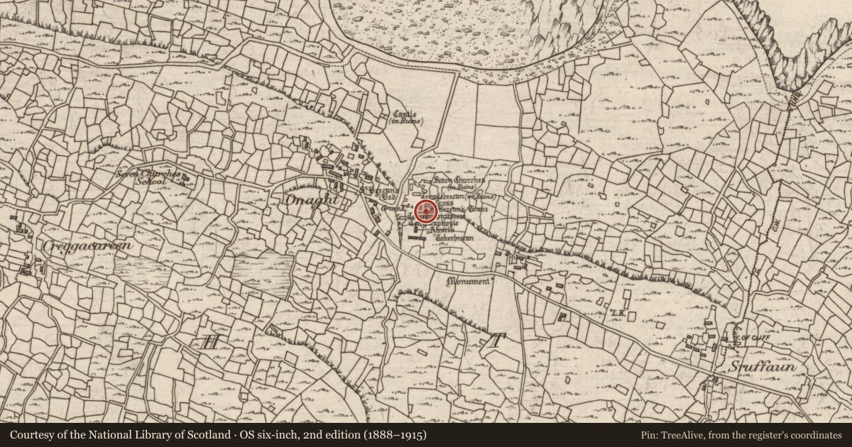
- First-edition OS map
- St. Brecans Grave
- Latest-edition OS map
- St. Brecans Grave
- Coordinates
- 53.14587, -9.77727
- SMR number
- GA110-023009-
Slide toward Today to fade the historical sheet and see the modern map underneath.
David Rumsey Map Collection, Stanford LibrariesDavid Rumsey Map Collection, Stanford LibrariesDavid Rumsey Map Collection, Stanford LibrariesDavid Rumsey Map Collection, Stanford Libraries
4 historical maps cover this location, the earliest the 1753 map "Mappa geographica Regni Hiberniae" (David Rumsey Map Collection, Stanford Libraries).
Historical maps covering this location
- 1753 · Mappa geographica Regni Hiberniae (David Rumsey Map Collection, Stanford Libraries)
- 1790 · Composite: Ireland. (David Rumsey Map Collection, Stanford Libraries)
- 1869 · Ireland. (David Rumsey Map Collection, Stanford Libraries)
- 1891 · Ireland 16 (David Rumsey Map Collection, Stanford Libraries)
This record in the National Monuments Service's Historic Environment Viewer ↗
The National Monuments Service's description
This is one of five leabaí or grave-plots (see also GA110-023001-, GA110-023002-, GA110-023003- and GA110-023005-) associated with Teampall Bhreacáin (GA110-010001-) and Teampall an Phoill (GA110-010003-). The multiple grave plot is labelled ‘St Brecan’s Grave’ by Robinson (1980). However, Waddell (1973, 26) equates the grave with Leaba Bhreacáin (GA110-023001-). It consists of a rectangular area (5m NNE-SSW; 2m NNW-SSE) bounded by a kerb of thin limestone slabs. The enclosed area is further subdivided into five slab-covered graves. Four cross-slabs (GA110-023021-, GA110-023022-, GA110-023023- and GA110-023024-) have been placed against its W edge (ibid.). (Gosling 1993, 145, no. 838)
Compiled by: Olive Alcock
Date of upload: 8 March 2016
References
Waddell, J. 1973 An archaeological survey of Temple Brecan, Aran. Journal of the Galway Archaeological and Historical Society 33, 5-27.
Gosling, P. (compiler) 1993 Archaeological inventory of County Galway, vol. 1: West Galway. Dublin. Stationery Office.
Robinson, T. 1990 Connemara. Part 1: Introduction and gazetteer; part 2: a one-inch map. Roundstone.
Nearby in the register
- Cross-inscribed pillarunder 1 mi
- Cross-slabunder 1 mi
- Cross-slabunder 1 mi
- Cross-inscribed pillarunder 1 mi
Other entries of the same register within about three miles of this one, by straight line.