Sites and Monuments Record · Ireland
Bullaun stone
Roscam, County Galway, Ireland
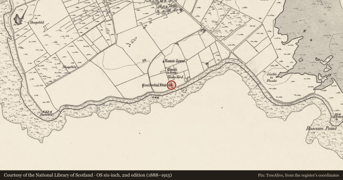
The record
- Townland
- Roscam
- County
- Galway
- Country
- Ireland
- First-edition OS map
- Holed Stone and Bullauns (Penitential Station)
- Latest-edition OS map
- Holed Stone and Bullauns (Penitential Station)
- Coordinates
- 53.26365, -8.98440
- SMR number
- GA094-072009-
Slide toward Today to fade the historical sheet and see the modern map underneath.
David Rumsey Map Collection, Stanford LibrariesDavid Rumsey Map Collection, Stanford LibrariesDavid Rumsey Map Collection, Stanford LibrariesDavid Rumsey Map Collection, Stanford Libraries
4 historical maps cover this location, the earliest the 1753 map "Mappa geographica Regni Hiberniae" (David Rumsey Map Collection, Stanford Libraries).
Historical maps covering this location
- 1753 · Mappa geographica Regni Hiberniae (David Rumsey Map Collection, Stanford Libraries)
- 1790 · Composite: Ireland. (David Rumsey Map Collection, Stanford Libraries)
- 1869 · Ireland. (David Rumsey Map Collection, Stanford Libraries)
- 1891 · Ireland 16 (David Rumsey Map Collection, Stanford Libraries)
This record in the National Monuments Service's Historic Environment Viewer ↗
The National Monuments Service's description
This triple bullaun stone (L 1.35m; H 0.95m; T 0.34m) is located c. 1m to the SE of a double bullaun stone (GA094-072008-) in the S section of the graveyard (GA094-072003-) within the early ecclesiastical enclosure (GA094-072002-) at Roscam. It is set upright in the ground with the basins facing SW. The uppermost basin (dims. 0.43m x 0.36m) is slightly larger than the middle one (dims. 0.41m x 0.3m). The lower basin (diam. 0.37m) is partially embedded in the ground. Both bullaun stones were regarded locally as holy wells (Fahey 1901a, 229). Named on the 1944-5 revision of the OS 6-inch maps as 'Penitential Station'.
The following images have been uploaded:
GA094-072009-_01 Triple bullaun stone with double bullaun stone (GA094-072008-) lying flat to its left
GA094-072009-_05 View from S
Compiled by: Olive Alcock
Date of upload: 19 May 2017
References
Fahey, J. 1901a Some antiquities in the neighbourhood of Oranmore and Kilcolgan, County Galway. Journal of the Royal Society of Antiquaries of Ireland 31, 228-35.
Nearby in the register
- Bullaun stoneunder 1 mi
- Graveyardunder 1 mi
- Graveslabunder 1 mi
- Holed stoneunder 1 mi
Other entries of the same register within about three miles of this one, by straight line.