Sites and Monuments Record · Ireland
Graveyard
Roscam, County Galway, Ireland
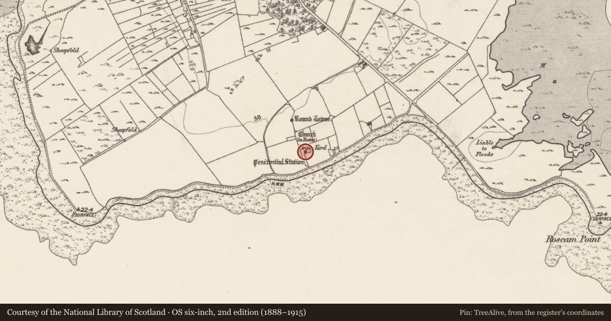
The record
- Townland
- Roscam
- County
- Galway
- Country
- Ireland
- First-edition OS map
- Grave Yd.
- Latest-edition OS map
- Grave Yard (Disused)
- Coordinates
- 53.26390, -8.98441
- SMR number
- GA094-072003-
Slide toward Today to fade the historical sheet and see the modern map underneath.
David Rumsey Map Collection, Stanford LibrariesDavid Rumsey Map Collection, Stanford LibrariesDavid Rumsey Map Collection, Stanford LibrariesDavid Rumsey Map Collection, Stanford Libraries
4 historical maps cover this location, the earliest the 1753 map "Mappa geographica Regni Hiberniae" (David Rumsey Map Collection, Stanford Libraries).
Historical maps covering this location
- 1753 · Mappa geographica Regni Hiberniae (David Rumsey Map Collection, Stanford Libraries)
- 1790 · Composite: Ireland. (David Rumsey Map Collection, Stanford Libraries)
- 1869 · Ireland. (David Rumsey Map Collection, Stanford Libraries)
- 1891 · Ireland 16 (David Rumsey Map Collection, Stanford Libraries)
This record in the National Monuments Service's Historic Environment Viewer ↗
The National Monuments Service's description
On a S-facing downslope in the S sector of an ecclesiastical enclosure (GA094-072002-). This graveyard, roughly P-shaped in plan (L c. 65m on W side; Wth c. 30m on N side; L c. 24m on E side; L of E side of stem of ‘P’ c. 35m; Wth c. 8m at S tip), is defined by a double-faced rubble-built drystone wall. Access is via a gateway at the SW end. Numerous grave-markers orientated E-W are visible, many running in a N-S running linear pattern. Inscribed headstones date to the 19th and 20th centuries. A possible leacht (GA0940972013-) is visible in the NE corner and an early Christian cross-slab (094-072012-), and medieval graveslabs (GA094-0720006- and GA094-072011-) are also associated. Within the S section are two multiple bullaun stones (GA094-072008- and GA094-072009-). Numerous dressed and moulded architectural fragments (GA094-072015-) are scattered throughout the graveyard.
The following image has been upload:
GA094-072003-_01 General view of graveyard from SSE
Compiled by: Olive Alcock
Date of upload: 19 May 2017
Nearby in the register
- Graveslabunder 1 mi
- Holed stoneunder 1 mi
- Graveslabunder 1 mi
- Cross-slabunder 1 mi
Other entries of the same register within about three miles of this one, by straight line.