Sites and Monuments Record · Ireland
Church
An Caorán Beag,Barr An Doire, County Galway, Ireland
The record
- Townland
- An Caorán Beag,Barr An Doire
- County
- Galway
- Country
- Ireland
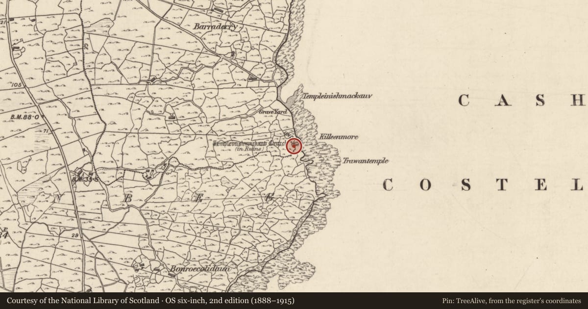
- First-edition OS map
- Templeinishmackaun Church (in ruins)
- Latest-edition OS map
- Templeinishmackaun Church (in Ruins)
- Coordinates
- 53.24813, -9.57865
- SMR number
- GA090-003001-
Slide toward Today to fade the historical sheet and see the modern map underneath.
David Rumsey Map Collection, Stanford LibrariesDavid Rumsey Map Collection, Stanford LibrariesDavid Rumsey Map Collection, Stanford LibrariesDavid Rumsey Map Collection, Stanford Libraries
4 historical maps cover this location, the earliest the 1753 map "Mappa geographica Regni Hiberniae" (David Rumsey Map Collection, Stanford Libraries).
Historical maps covering this location
- 1753 · Mappa geographica Regni Hiberniae (David Rumsey Map Collection, Stanford Libraries)
- 1790 · Composite: Ireland. (David Rumsey Map Collection, Stanford Libraries)
- 1869 · Ireland. (David Rumsey Map Collection, Stanford Libraries)
- 1891 · Ireland 16 (David Rumsey Map Collection, Stanford Libraries)
This record in the National Monuments Service's Historic Environment Viewer ↗
The National Monuments Service's description
Close to seashore on W side of Cuan Chasla and 85m S of an irregularly shaped graveyard (GA090-002----). Though properly known as Teampall Inis Mac Adhaimh, this well-preserved medieval church (ENE-WSW; L 15.60m; Wth 5m) is, however, attributed locally to a St Mocán or Smocán (pers. comm. T. Robinson). There is a robbed doorway in S wall, the scattered fragments of which indicate it had a pointed arch and moulded architrave. Directly opposite, in N wall, is a later doorway with a pointed arch. A cusped ogee-headed window in E gable has decorated spandrels and a hood-moulding. Later internal division at W end with a possible gallery above; possibly a priest's quarters. (Killanin 1947, 130; Hardiman 1846, 63, 64)
The above description is derived from the published 'Archaeological Inventory of County Galway Vol. I - West Galway'. Compiled by Paul Gosling (Dublin: Stationery Office, 1993).
Date of upload: 05 August 2010
The following images have been uploaded:
GA090-003001-_01.jpg View from NE
GA090-003001-_03.jpg E window
GA090-003001-_04.jpg Detail of decorated spandral
GA090-003001-_05.jpg Robbed doorway in S wall
GA090-003001-_11.jpg Blocked doorway in N wall
Nearby in the register
- Burial groundunder 1 mi
- Chapelunder 1 mi
- Middenunder 1 mi
- Martello towerunder 1 mi
Other entries of the same register within about three miles of this one, by straight line.