Sites and Monuments Record · Ireland
Cross-slab (present location)
Raheen (Athenry By.), County Galway, Ireland
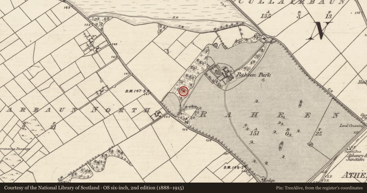
The record
- Townland
- Raheen (Athenry By.)
- County
- Galway
- Country
- Ireland
- First-edition OS map
- Not indicated
- Latest-edition OS map
- Not indicated
- Coordinates
- 53.30195, -8.76346
- SMR number
- GA084-151030-
Slide toward Today to fade the historical sheet and see the modern map underneath.
David Rumsey Map Collection, Stanford LibrariesDavid Rumsey Map Collection, Stanford LibrariesDavid Rumsey Map Collection, Stanford LibrariesDavid Rumsey Map Collection, Stanford Libraries
4 historical maps cover this location, the earliest the 1753 map "Mappa geographica Regni Hiberniae" (David Rumsey Map Collection, Stanford Libraries).
Historical maps covering this location
- 1753 · Mappa geographica Regni Hiberniae (David Rumsey Map Collection, Stanford Libraries)
- 1790 · Composite: Ireland. (David Rumsey Map Collection, Stanford Libraries)
- 1869 · Ireland. (David Rumsey Map Collection, Stanford Libraries)
- 1891 · Ireland 16 (David Rumsey Map Collection, Stanford Libraries)
This record in the National Monuments Service's Historic Environment Viewer ↗
The National Monuments Service's description
This cross-slab (H 1.1m; max. Wth 0.69m; T 0.07m) was found ‘among the ruins of the church [WM015-001----] on the island of Inisbofin, in Lough Ree’ (Petrie and Stokes 1872, Vol. 1, 57, Fig. 122). A drawing by Stokes (ibid.), from a rubbing of the slab taken in 1869 by Rev. James Graves, shows a two-line ringed cross with a central circle and plain straight ended terminals, apart from the base which was looped. An inscription, in two lines, across the top of the slab reads [O]ROIT DO [C]ORMACAN (Pray for Cormacán). Due to a fracture, the letters O on the first line and C on the second line were missing. When visited by Macalister (1912, 29-30), the slab had been broken into three pieces. It has since been repaired and is currently kept in the OPW depot in Athenry. See WM015-001007- for its original location. (Crawford 1913, 329, 1. (a); Macalister 1949, vol. 2, 79, no. 873, Pl. VII; Commissioners of Public Works in Ireland 1913, Appendix E, Slab E)
Compiled by: Olive Alcock
Date of upload: 2 March 2023
Commissioners of Public Works in Ireland 1913 Eighty-first annual report of the Commissioners of Public Works in Ireland with appendices for the year ending 31st March 1913. London. HMSO.
Petrie, G. and Stokes, M. (ed.) 1872-8 Christian inscriptions in the Irish language. 2 vols. Dublin. Royal Historical and Archaeological Association.
References
Macalister, R.A.S. 1912 Some cross-slabs in the neighbourhood of Athlone. Journal of the Royal Society of Antiquaries of Ireland 42, 27-31.
Macalister, R.A.S. 1949 Corpus Inscriptionum Insularum Celticarum, 2 vols. Dublin. Irish Manuscripts Commission.
Crawford, H.S. 1913 A descriptive list of early cross-slabs and pillars. (cont.) Journal of the Royal Society of Antiquaries of Ireland 43, 151-69, 261-5, 326-34.
Nearby in the register
- Cross-slab (present location)under 1 mi
- Cross-slab (present location)under 1 mi
- Cross-slab (present location)under 1 mi
- Cross-slab (present location)under 1 mi
Other entries of the same register within about three miles of this one, by straight line.