Sites and Monuments Record · Ireland
Cross-slab (present location)
Raheen (Athenry By.), County Galway, Ireland
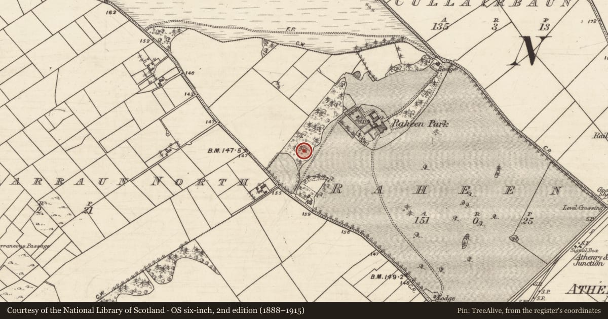
The record
- Townland
- Raheen (Athenry By.)
- County
- Galway
- Country
- Ireland
- First-edition OS map
- Not indicated
- Latest-edition OS map
- Not indicated
- Coordinates
- 53.30195, -8.76346
- SMR number
- GA084-151006-
Slide toward Today to fade the historical sheet and see the modern map underneath.
David Rumsey Map Collection, Stanford LibrariesDavid Rumsey Map Collection, Stanford LibrariesDavid Rumsey Map Collection, Stanford LibrariesDavid Rumsey Map Collection, Stanford Libraries
4 historical maps cover this location, the earliest the 1753 map "Mappa geographica Regni Hiberniae" (David Rumsey Map Collection, Stanford Libraries).
Historical maps covering this location
- 1753 · Mappa geographica Regni Hiberniae (David Rumsey Map Collection, Stanford Libraries)
- 1790 · Composite: Ireland. (David Rumsey Map Collection, Stanford Libraries)
- 1869 · Ireland. (David Rumsey Map Collection, Stanford Libraries)
- 1891 · Ireland 16 (David Rumsey Map Collection, Stanford Libraries)
This record in the National Monuments Service's Historic Environment Viewer ↗
The National Monuments Service's description
Macalister (1916-17, 151, no. 21, and plate XVI) recorded this cross-slab on the N wall of the chancel of St Caimin's Church (CL029-009011-), on Inis Cealtra (Holy Island), Co. Clare. He described it as being of 'Eight-century type' and it measured '1 foot 7 inches by 1 foot 1 inch by 3 inches [0.48m by 0.33m by 0.07m]. Within a circle of two lines, a cross formed of four arcs of circles, with interlacing at the intersection, was visible. The ends of the arcs terminated with a spiral treatment and within the cantons were triskeles of one line. When de Paor recorded the slab in the 1970s (SMR file), it was on the S wall of the nave of the church. It is currently in the OPW depot in Athenry, Co. Galway. See CL029-009032- for original location.
Compiled by: Olive Alcock
Date of upload: 16 February 2023
References
Macalister, R.A.S 1916-17 The history and antiquities of Inis Cealtra. Proceedings of the Royal Irish Academy, 33C, 93-174.
SMR file - Sites and monuments record files in the National Monuments Service, Department of Housing, Local Government and Heritage.
Nearby in the register
- Cross-slab (present location)under 1 mi
- Cross-slab (present location)under 1 mi
- Cross-slab (present location)under 1 mi
- Cross-slab (present location)under 1 mi
Other entries of the same register within about three miles of this one, by straight line.