Sites and Monuments Record · Ireland
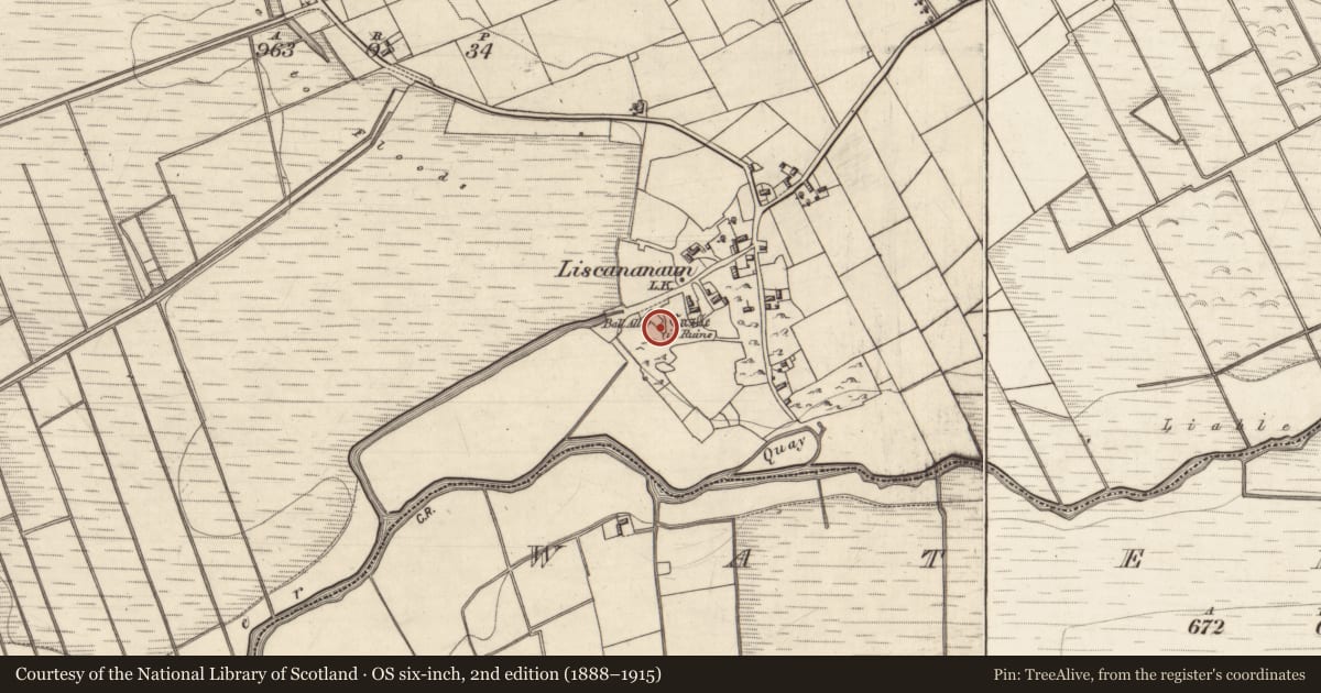
Castle - tower house
Liscananaun, County Galway, Ireland
The record
- Townland
- Liscananaun
- County
- Galway
- Country
- Ireland
- First-edition OS map
- Castle
- Latest-edition OS map
- Castle (in Ruins)
- Coordinates
- 53.36839, -8.96609
- SMR number
- GA069-026----
Slide toward Today to fade the historical sheet and see the modern map underneath.
David Rumsey Map Collection, Stanford LibrariesDavid Rumsey Map Collection, Stanford LibrariesDavid Rumsey Map Collection, Stanford LibrariesDavid Rumsey Map Collection, Stanford Libraries
4 historical maps cover this location, the earliest the 1753 map "Mappa geographica Regni Hiberniae" (David Rumsey Map Collection, Stanford Libraries).
Historical maps covering this location
- 1753 · Mappa geographica Regni Hiberniae (David Rumsey Map Collection, Stanford Libraries)
- 1790 · Composite: Ireland. (David Rumsey Map Collection, Stanford Libraries)
- 1869 · Ireland. (David Rumsey Map Collection, Stanford Libraries)
- 1891 · Ireland 16 (David Rumsey Map Collection, Stanford Libraries)
This record in the National Monuments Service's Historic Environment Viewer ↗
The National Monuments Service's description
On a slight rise overlooking marshy ground to S and W. In existence in 1574 when it was in the possession of 'Tybbot Lyegh' (Nolan 1901b, 118). When first visited in 1983, only a tottering section of W wall (L 2.7m) of this tower survived to a height of four storeys. The following architectural features were noted: an arched embrasure on ground floor; a doorway on 2nd floor leading to an intramural passage; a series of intramural features on 2nd/3rd floors, possibly fireplaces; the springing of a possible stone vault between 2nd/3rd floors; and a small cupboard on 3rd floor. The wall subsequently collapsed during a storm, c. 1990, and is now just a spread of rubble. A series of mounds and hollows visible to E, S and W may represent traces of the bawn.
The above description is derived from the published 'Archaeological Inventory of County Galway Vol. II - North Galway'. Compiled by Olive Alcock, Kathy de hÓra and Paul Gosling (Dublin: Stationery Office, 1999).
Date of upload: 05 August 2010
Nearby in the register
- Children's burial groundunder 1 mi
- Religious house - unclassifiedunder 1 mi
- Ringfort - unclassifiedunder 1 mi
- Church1 mi
Other entries of the same register within about three miles of this one, by straight line.