Sites and Monuments Record · Ireland
Church
High Island, County Galway, Ireland
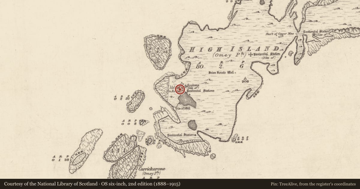
The record
- Townland
- High Island
- County
- Galway
- Country
- Ireland
- First-edition OS map
- Abbey
- Latest-edition OS map
- Abbey (in Ruins)
- Coordinates
- 53.54478, -10.26119
- SMR number
- GA021-026014-
Slide toward Today to fade the historical sheet and see the modern map underneath.
David Rumsey Map Collection, Stanford LibrariesDavid Rumsey Map Collection, Stanford LibrariesDavid Rumsey Map Collection, Stanford LibrariesDavid Rumsey Map Collection, Stanford Libraries
4 historical maps cover this location, the earliest the 1790 map "Composite: Ireland." (David Rumsey Map Collection, Stanford Libraries).
Historical maps covering this location
- 1790 · Composite: Ireland. (David Rumsey Map Collection, Stanford Libraries)
- 1841 · Ireland. (David Rumsey Map Collection, Stanford Libraries)
- 1869 · Ireland. (David Rumsey Map Collection, Stanford Libraries)
- 1891 · Ireland 16 (David Rumsey Map Collection, Stanford Libraries)
This record in the National Monuments Service's Historic Environment Viewer ↗
The National Monuments Service's description
This church is located within a small enclosure (GA021-026021-), which lies in the N half of the ecclesiastical enclosure (GA021-026022-) on High Island. It comprises a conserved single-cell church, dedicated to St Féichín, and is one of the smallest of the Atlantic island churches. Described by Scally (1914, 42, 52-65) as being almost square in plan (3.43m E-W; 3.14m N-S). There are three distinct building phases, the earliest dating from the mid- to late 11th century and most of the masonry relates to this phase. The church post-dates the earliest phases of activity at the monastery (see GA021-026021- and GA021-026026-) as evidenced by the incorporation of the headstones of a number of earlier graves within the foundations of the external face of its E wall. The N and S side-walls (Wth 0.7-0.75m) survive to full height. A trabeate doorway (Wth 0.8-0.9m) in the W wall is slightly off-centre to the N. Its internal lintel is a reused cross-slab (GA021-026023-). Prior to conservation works most of the central section of the E wall (Wth 0.82-1m) had collapsed. It has been rebuilt and the reconstruction of its small deeply splayed round-headed window is based on the recovery of its window head and sill stone. Within the church there is an aumbry at the N end of the E wall. It is unusual as there is an additional concealed cavity below it and its upper level steps back beyond the line of the N wall. A roughly square altar (1.1m N-S; 1.05m E-W; H c. 0.9m) is built against the E wall, in line with the doorway opposite it. A decorated cross-slab (GA021-026049-) is incorporated into its S side (ibid., 65-7). A holy water stoup and a cross-base (GA021-026075-) that had been placed upon it (White Marshall and Rourke 2000, 84) have been removed and are now in the care of the OPW (see GA084-151027-). During conservation works another broken decorated cross-slab (GA021-026049-) was found lying face down at its base. Excavations within the church revealed evidence of a paved surface. Two graves were recovered, one in the NE corner and one in the NW corner (GA021-026026-), and the base of a leacht (GA021-026083-) was found in the SW corner (Scally ibid., 306-9). (White Marshall and Rourke 2000, 69-91)
Updated by: Olive Alcock
Date of revised upload: 26 February 2019
This monument was taken into Ownership under the National Monuments Acts 1930 to 2014 - National Monument 52.
The following images have been appended:
GA021-026014-_01.jpg Aerial view of monastic site prior to conservation
GA021-026014-_02.jpg Aerial view post conservation
GA021-026014-_03.jpg View of conserved church from NW
GA021-026014-_04.jpg View of E window and altar from W
GA021-026014-_05.jpg Doorway from E, note reuse of cross-slab (GA021-026023-) as lintel
GA021-026014-_06.jpg E window, internal view
GA021-026014-_07.jpg E window, external view
References
White Marshall, J. and Rourke, G.D. 2000 High Island: an Irish monastery in the Atlantic. Dublin. Town House and Country House.
Scally, G. 2014 High Island (Ardoileán), Co. Galway: excavation of an early medieval monastery. Archaeological Monograph Series 10. Dublin. The Stationery Office.
Healy, J. 1890 An island shrine in the west. The Irish Ecclesiastical Record, 673-86.
Macalister, R.A.S. 1896a The antiquities of Ardoilean, County Galway. Journal of the Royal Society of Antiquaries of Ireland 26, 197-210.
Nearby in the register
- Clochanunder 1 mi
- Clochanunder 1 mi
- Cross-slabunder 1 mi
- Graveyardunder 1 mi
Other entries of the same register within about three miles of this one, by straight line.