Sites and Monuments Record · Ireland
Enclosure
Kilcloony (Dunmore By.), County Galway, Ireland
The record
- Townland
- Kilcloony (Dunmore By.)
- County
- Galway
- Country
- Ireland
- First-edition OS map
- Not indicated
- Latest-edition OS map
- Not indicated
- Coordinates
- 53.59129, -8.87146
- SMR number
- GA016-062008-
Slide toward Today to fade the historical sheet and see the modern map underneath.
David Rumsey Map Collection, Stanford LibrariesDavid Rumsey Map Collection, Stanford LibrariesDavid Rumsey Map Collection, Stanford LibrariesDavid Rumsey Map Collection, Stanford Libraries
4 historical maps cover this location, the earliest the 1753 map "Mappa geographica Regni Hiberniae" (David Rumsey Map Collection, Stanford Libraries).
Historical maps covering this location
- 1753 · Mappa geographica Regni Hiberniae (David Rumsey Map Collection, Stanford Libraries)
- 1790 · Composite: Ireland. (David Rumsey Map Collection, Stanford Libraries)
- 1869 · Ireland. (David Rumsey Map Collection, Stanford Libraries)
- 1891 · Ireland 16 (David Rumsey Map Collection, Stanford Libraries)
This record in the National Monuments Service's Historic Environment Viewer ↗
The National Monuments Service's description
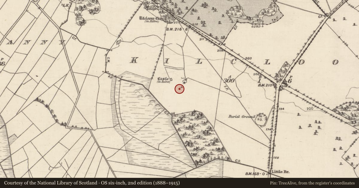
During the course of a site inspection of Kilcloony Castle (GA016-062001-) and bawn (GA016-062005-) in August 1980, a possible enclosure was recorded to the SE of the bawn. It was indicated by a change in vegetation colour, which defined a rectangular area (26.5m E-W; 23m N-S). Some stone visible in the surface of the vegetation band (Wth 3.5m) indicated that it may have been the remains of a levelled wall that may have been an outer enclosure around the castle (SMR file). It is clearly visible on an aerial photograph taken in July 1967 (CUCAP ATF 57). It is also possible that this feature is part of the field system (GA016-062002-).
Compiled by: Olive Alcock
Date of upload: 6 December 2022
References
SMR file - Sites and monuments record files in the National Monuments Service, Department of Housing, Local Government and Heritage.
CUCAP - Cambridge University Collection of Aerial Photographs. Unit for Landscape Modelling, Department of Geography, University of Cambridge. See:https://www.cambridgeairphotos.com
Nearby in the register
- Structureunder 1 mi
- Bawnunder 1 mi
- Structureunder 1 mi
- Castle - tower houseunder 1 mi
Other entries of the same register within about three miles of this one, by straight line.