Sites and Monuments Record · Ireland
Graveyard
Knock (Inishbofin Par.), County Galway, Ireland
The record
- Townland
- Knock (Inishbofin Par.)
- County
- Galway
- Country
- Ireland
- First-edition OS map
- Grave Yard
- Latest-edition OS map
- Grave Yard
- Coordinates
- 53.61553, -10.18866
- SMR number
- GA009D014002-
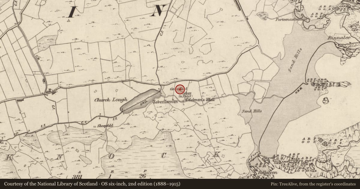
Slide toward Today to fade the historical sheet and see the modern map underneath.
David Rumsey Map Collection, Stanford LibrariesDavid Rumsey Map Collection, Stanford LibrariesDavid Rumsey Map Collection, Stanford LibrariesDavid Rumsey Map Collection, Stanford Libraries
4 historical maps cover this location, the earliest the 1790 map "Composite: Ireland." (David Rumsey Map Collection, Stanford Libraries).
Historical maps covering this location
- 1790 · Composite: Ireland. (David Rumsey Map Collection, Stanford Libraries)
- 1841 · Ireland. (David Rumsey Map Collection, Stanford Libraries)
- 1869 · Ireland. (David Rumsey Map Collection, Stanford Libraries)
- 1891 · Ireland 16 (David Rumsey Map Collection, Stanford Libraries)
This record in the National Monuments Service's Historic Environment Viewer ↗
The National Monuments Service's description
Located in an area of rough pastureland and outcropping rock at the SE end of Inisbofin Island and immediately to the S of a roadway. Indicated as a roughly rectangular graveyard (c. 98m NNE-SSW; c. 60m E-W) on the 1896 resurvey of the OS 6-inch map, it has since been extended to the W. A medieval church (GA099D014001-) is located in its S half and traces of a possible ecclesiastical enclosure (GA009D014003-), defined by a scarp line, are visible around the church from N through E to SE. Two holy wells are located within it at SW (GA009D014005-) and SE (GA009D014004-), as well as a bullaun (GA009D014008-). A number of cross-slabs (GA009D014006-, GA009D014007-, GA009D014010-, GA009D014011-) and two crosses (GA009D014012-, GA009D014013-) are also associated. The earliest burials occur around the church and consist of stone-lined graves and simple grave-markers. Modern burials occur to the N and NW of the church and the extension to the W. The graveyard is enclosed by a capped boulder wall and access is gained at NW.
Compiled by: Olive Alcock
Date of upload: 15 June 2018
Nearby in the register
- Cross-slabunder 1 mi
- Cross-slabunder 1 mi
- Cross-slabunder 1 mi
- Cross-slabunder 1 mi
Other entries of the same register within about three miles of this one, by straight line.