Sites and Monuments Record · Ireland
Church
Newtown Upper, County Dublin, Ireland
The record
- Townland
- Newtown Upper
- County
- Dublin
- Country
- Ireland
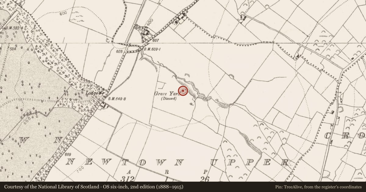
- Latest-edition OS map
- The Rilligeen (Burial Ground Disused)
- Coordinates
- 53.26039, -6.49049
- SMR number
- DU024-001001-
Slide toward Today to fade the historical sheet and see the modern map underneath.
David Rumsey Map Collection, Stanford LibrariesDavid Rumsey Map Collection, Stanford LibrariesDavid Rumsey Map Collection, Stanford LibrariesDavid Rumsey Map Collection, Stanford Libraries
4 historical maps cover this location, the earliest the 1799 map "Ireland." (David Rumsey Map Collection, Stanford Libraries).
Historical maps covering this location
- 1799 · Ireland. (David Rumsey Map Collection, Stanford Libraries)
- 1811 · Ireland. (David Rumsey Map Collection, Stanford Libraries)
- 1830 · V.3:11-15:XV. Britisches Reich. C. Kon: Ireland. a. Prov: Leinster. Counties: 1-12 (David Rumsey Map Collection, Stanford Libraries)
- 1891 · Ireland 16 (David Rumsey Map Collection, Stanford Libraries)
This record in the National Monuments Service's Historic Environment Viewer ↗
The National Monuments Service's description
Situated in pastureland on the brow of a small valley overlooking a stream. The OS Letters describe the remains of a church at Newtown Upper (Herity 2001, 48). A section of wall stood at the SW angle, the remainder survived as foundations (dims L c. 4.5m, Wth 3m). The church remains appear today as an oblong mound (L 6m, Wth 4m).
The church is surrounded by a circular bank and external fosse (int. diam.21m). It has been used for the burial unbaptised children (DU024-001002-) and maybe the remains of an early ecclesiastical enclosure (DU024-001003-; Healy 1975, 1-19; Ua Broin 1943, 87-88).
Compiled by: Geraldine Stout and Padraig Clancy
Revised upload on: 6 July 2018
References
Healy, P. 1975a Second report on monuments and sites of archaeological interest in county Dublin. An Foras Forbartha Teoranta.
Ua Broin, L. 1943 Rathcoole, County Dublin and its neighbourhood. Journal of the Royal Society of Antiquaries of Ireland 73, 88.
Herity, M. (ed.) 2001 Ordnance Survey Letters: Meath. Dublin. Four Masters Press
Nearby in the register
- Children's burial groundunder 1 mi
- Ecclesiastical enclosureunder 1 mi
- Cairn - unclassifiedunder 1 mi
- Barrow - ring-barrowunder 1 mi
Other entries of the same register within about three miles of this one, by straight line.