Sites and Monuments Record · Ireland
Ecclesiastical site
Woodland, County Dublin, Ireland
The record
- Townland
- Woodland
- County
- Dublin
- Country
- Ireland
- First-edition OS map
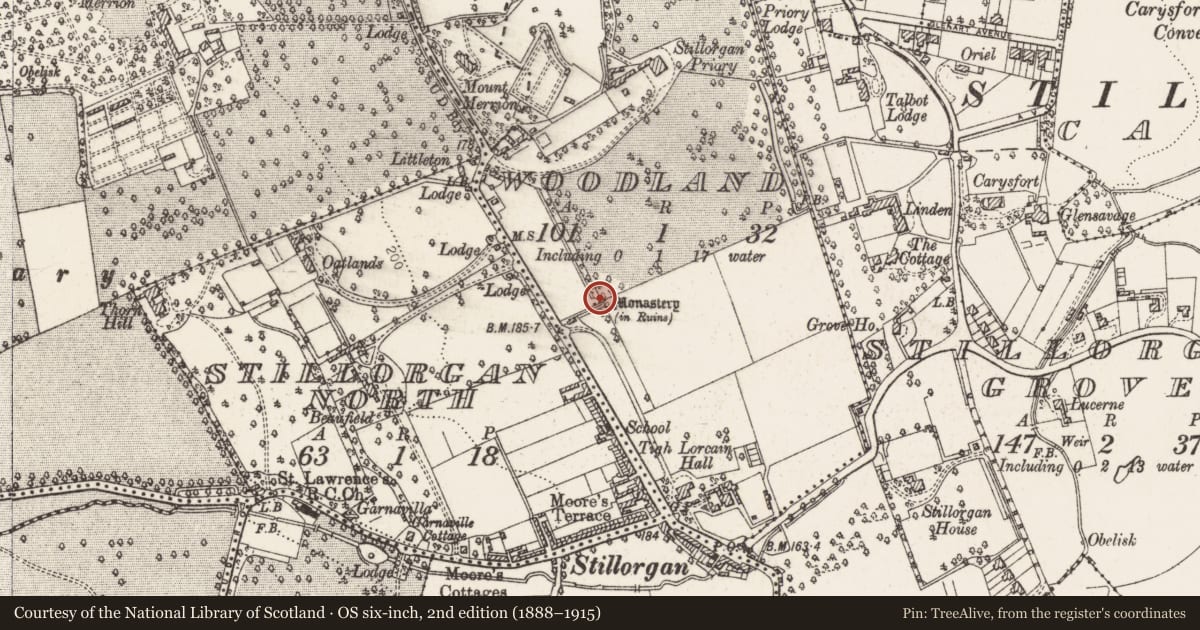
- Monastery (in ruins)
- Latest-edition OS map
- Monastery (in Ruins)
- Coordinates
- 53.29165, -6.19968
- SMR number
- DU023-007----
Slide toward Today to fade the historical sheet and see the modern map underneath.
David Rumsey Map Collection, Stanford LibrariesDavid Rumsey Map Collection, Stanford LibrariesDavid Rumsey Map Collection, Stanford LibrariesDavid Rumsey Map Collection, Stanford Libraries
4 historical maps cover this location, the earliest the 1799 map "Ireland." (David Rumsey Map Collection, Stanford Libraries).
Historical maps covering this location
- 1799 · Ireland. (David Rumsey Map Collection, Stanford Libraries)
- 1811 · Ireland. (David Rumsey Map Collection, Stanford Libraries)
- 1841 · Ireland. (David Rumsey Map Collection, Stanford Libraries)
- 1891 · Ireland 16 (David Rumsey Map Collection, Stanford Libraries)
This record in the National Monuments Service's Historic Environment Viewer ↗
The National Monuments Service's description
Site annotated 'Monastery (in ruins)' on the 1837 ed. OSi 6-inch map where a possible structure is shown to the E of the Gate lodge on the landscaped demesne lands of Stillorgan Priory located 320m to the NNE. Three small rectangular structures standing on the N side of a field boundary running NE-SW are depicted on the 1863 ed. OSi 25-inch map. According to Ball (1902, 129), the house Stillorgan Priory was named after the monastery ruins located on the demesne lands. Today the site of the monastery stands 680m N of Stillorgan church and graveyard, in a flat urban site between the N11 Stillorgan Road and the Old Dublin Road. The monastery ruins on the 1837 ed. OSi 6-inch may have formed part of the church lands in Stillorgan which in 1216 were granted by Raymond Carew to the Priory of the Holy Trinity (Christchurch Cathedral DU018-020270-) (Ball 1902, 130). Today there are no surface remains visible, a car park and small wooded area now stands on the site of the possible monastery (Healy 1975).
Compiled by: Geraldine Stout and Padraig Clancy
Revised by: Caimin O'Brien
Date of revised upload: 27 April 2023
References
Healy, P. 1975a Second report on monuments and sites of archaeological interest in county Dublin. An Foras Forbartha Teoranta.
Ball, E.F. 1902-20 (Reprint 1979) A history of the County Dublin, 6 vols. Dublin. Gill and Macmillan.
Nearby in the register
- House - medievalunder 1 mi
- Flat cemeteryunder 1 mi
- Graveyardunder 1 mi
- Graveslabunder 1 mi
Other entries of the same register within about three miles of this one, by straight line.