Sites and Monuments Record · Ireland
House - medieval
Stillorgan Grove, County Dublin, Ireland
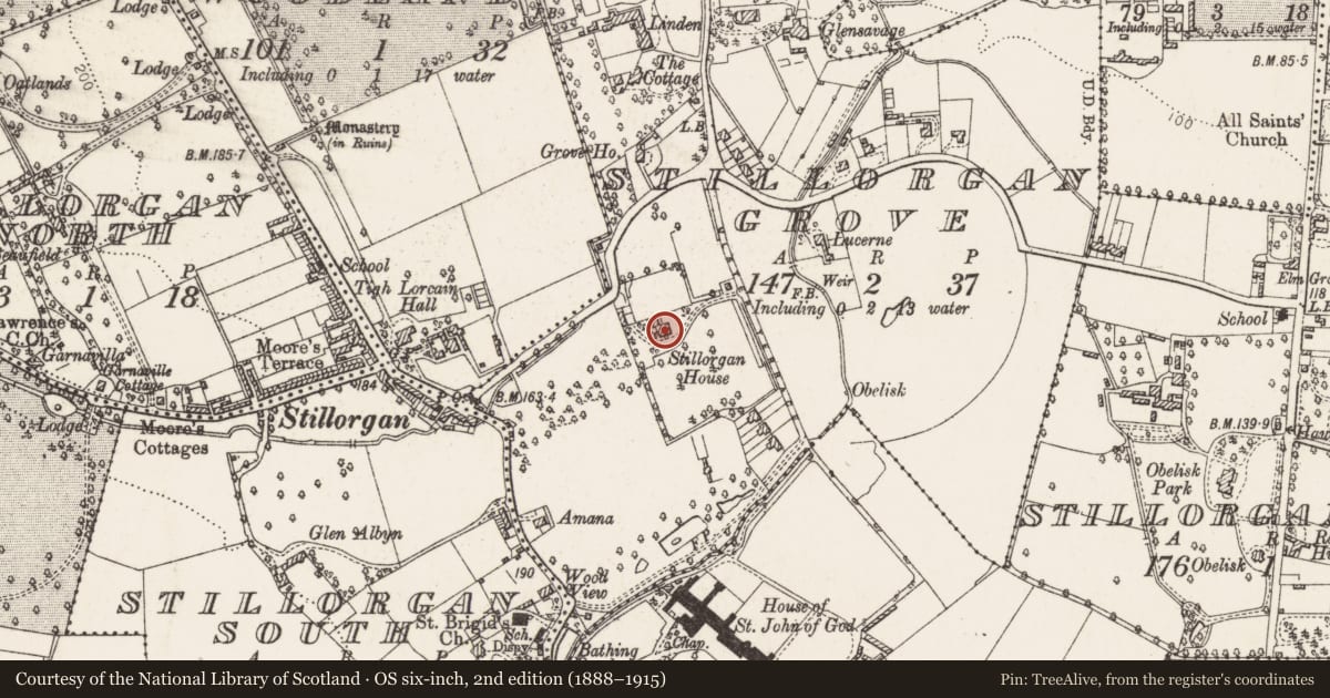
The record
- Townland
- Stillorgan Grove
- County
- Dublin
- Country
- Ireland
- Latest-edition OS map
- Indicated
- Coordinates
- 53.28925, -6.19284
- SMR number
- DU023-012001-
Slide toward Today to fade the historical sheet and see the modern map underneath.
David Rumsey Map Collection, Stanford LibrariesDavid Rumsey Map Collection, Stanford LibrariesDavid Rumsey Map Collection, Stanford LibrariesDavid Rumsey Map Collection, Stanford Libraries
4 historical maps cover this location, the earliest the 1799 map "Ireland." (David Rumsey Map Collection, Stanford Libraries).
Historical maps covering this location
- 1799 · Ireland. (David Rumsey Map Collection, Stanford Libraries)
- 1811 · Ireland. (David Rumsey Map Collection, Stanford Libraries)
- 1841 · Ireland. (David Rumsey Map Collection, Stanford Libraries)
- 1891 · Ireland 16 (David Rumsey Map Collection, Stanford Libraries)
This record in the National Monuments Service's Historic Environment Viewer ↗
The National Monuments Service's description
Situated in a flat urban site. Site marked as 'Sillorgan House' the site may mark the location of the original manor house, or main residence of the lord of the manor, which by 1360 was occupied by Sir John Cruise. The Wolverston family resided here during the 16th/17th century between the dissolution of the monasteries and the Cromwellian period. Stillorgan House is mentioned in the Depositions of 1641 (Stokes 1895, 8-9). Improvements were made to that house in 1684 by Sir Joshua Allen, said to be a master builder. In 1695 the then owner Viscount John Allen replaced the fortified manor house with a large mansion. This was described as "a house with wings containing, on one side a miniature theater and on the other side, the stables and enclosing in the centre a large courtyard, the gardens were so extensive as to cover 12 acres and were laid out in the old fashioned style" Internally it was recorded as having a splendid mantelpiece, representing the judgement of Solomon (Stokes 1895, 9). A water-colour owned by Mr Verschoyle which depicts the house, shows a seven-bay two storey mansion over semi-basement, with projecting front gables either end of the façade and with side wings attached to the main house by rails (op. cit, 9). There were dormer windows in the attic storey and large chimneystacks. Demolished c. 1880. No visible surface remains.
Compiled by: Geraldine Stout and Padraig Clancy
Revised upload on: 22 May 2018
References
Stokes, Rev. G.T. 1895 The antiquities from Kingstown to Dublin. Journal of the Royal Society of Antiquaries of Ireland 25, 5-15.
Nearby in the register
- Flat cemeteryunder 1 mi
- Castle - unclassifiedunder 1 mi
- Graveyardunder 1 mi
- Graveslabunder 1 mi
Other entries of the same register within about three miles of this one, by straight line.