Sites and Monuments Record · Ireland
Cross-slab
Saggart, County Dublin, Ireland
The record
- Townland
- Saggart
- County
- Dublin
- Country
- Ireland
- First-edition OS map
- Not indicated
- Latest-edition OS map
- Not indicated
- Coordinates
- 53.28144, -6.44459
- SMR number
- DU021-034004-
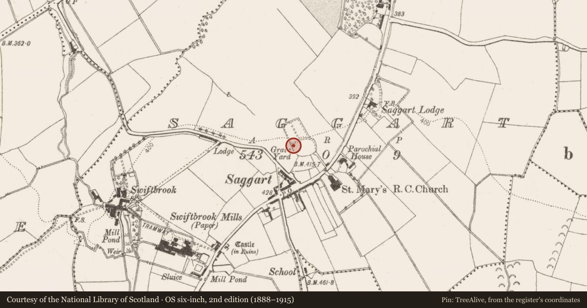
Slide toward Today to fade the historical sheet and see the modern map underneath.
David Rumsey Map Collection, Stanford LibrariesDavid Rumsey Map Collection, Stanford LibrariesDavid Rumsey Map Collection, Stanford LibrariesDavid Rumsey Map Collection, Stanford Libraries
4 historical maps cover this location, the earliest the 1799 map "Ireland." (David Rumsey Map Collection, Stanford Libraries).
Historical maps covering this location
- 1799 · Ireland. (David Rumsey Map Collection, Stanford Libraries)
- 1811 · Ireland. (David Rumsey Map Collection, Stanford Libraries)
- 1830 · V.3:11-15:XV. Britisches Reich. C. Kon: Ireland. a. Prov: Leinster. Counties: 1-12 (David Rumsey Map Collection, Stanford Libraries)
- 1891 · Ireland 16 (David Rumsey Map Collection, Stanford Libraries)
This record in the National Monuments Service's Historic Environment Viewer ↗
The National Monuments Service's description
Granite slab or pillar-stone with rounded or hogback shape set upright in the NW end of Saggart graveyard (DU021-034003-). It is shaped and bordered and bears a single shaft with a ring-headed cross at each end and mouldings along the edge (dims. L 1.42m, Wth 0.32-0.47m, T 0.25-0.39m). Ó hÉalidhe has suggested a tenth-century date (Ó hÉalidhe 1973, 103, 61; Bradley & King 1987, 2, 294; Swords 2009, 101).
To see a 3D model of the cross-slab visit https://skfb.ly/oEBCs
Compiled by: Geraldine Stout
Revised by: Caimin O'Brien
Date of revised upload: 24 March 2023
References
Ó hÉalidhe, P. and Prendergast, E. 1977 Two unrecorded graveslabs in county Dublin. Journal of the Royal Society of Antiquaries of Ireland 101, 146-53.
Swords, K. (ed.) 2009 Pre-Norman grave-slabs and cross-inscribed stones in the Dublin region. 2009 edition of an NUIG MA thesis prepared in 1985. Tallaght, Dublin. Local Studies Section, South Dublin Library.
Bradley, J. & King, H. (1987) Urban Archaeological Survey, Dublin. A report commissioned by the Office of Public works (Unpublished).
Nearby in the register
- Crossunder 1 mi
- Graveyardunder 1 mi
- Stone headunder 1 mi
- Crossunder 1 mi
Other entries of the same register within about three miles of this one, by straight line.