Sites and Monuments Record · Ireland
Ritual site - holy well
Crowscastle, County Dublin, Ireland
The record
- Townland
- Crowscastle
- County
- Dublin
- Country
- Ireland
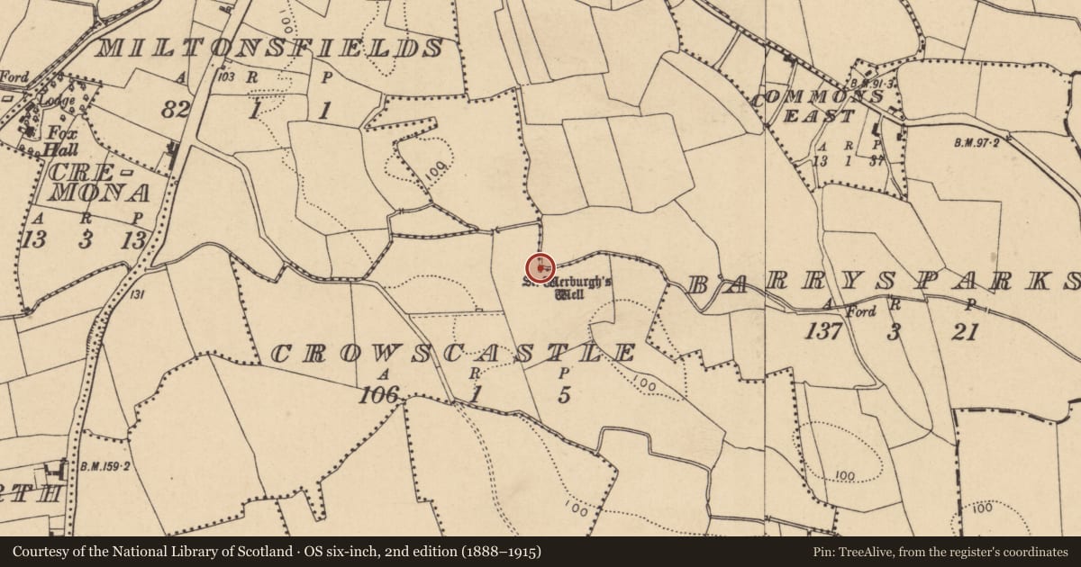
- First-edition OS map
- St. Werburghs Well
- Latest-edition OS map
- St. Werburghs Well
- Coordinates
- 53.44913, -6.21718
- SMR number
- DU011-045----
Slide toward Today to fade the historical sheet and see the modern map underneath.
David Rumsey Map Collection, Stanford LibrariesDavid Rumsey Map Collection, Stanford LibrariesDavid Rumsey Map Collection, Stanford LibrariesDavid Rumsey Map Collection, Stanford Libraries
4 historical maps cover this location, the earliest the 1799 map "Ireland." (David Rumsey Map Collection, Stanford Libraries).
Historical maps covering this location
- 1799 · Ireland. (David Rumsey Map Collection, Stanford Libraries)
- 1811 · Ireland. (David Rumsey Map Collection, Stanford Libraries)
- 1841 · Ireland. (David Rumsey Map Collection, Stanford Libraries)
- 1891 · Ireland 16 (David Rumsey Map Collection, Stanford Libraries)
This record in the National Monuments Service's Historic Environment Viewer ↗
The National Monuments Service's description
Dedicated to St Werburgh, the natural spring well was overgrown, situated beside a stream which forms the townland boundary between Crowscastle and Barrysparks. There was a local tradition that its water cures sore eyes but by the 1950s was no longer venerated (Ó Danachair 1958, 81). Holy well described in 1975 as; 'Small concrete enclosure now dry and full of brambles. It is beside a stream, which has partly eroded one corner of the foundations' (Henry A. Wheeler 08/10/1975, SMR File). Folklore collected from Swords School recorded that; 'There is another holy well about three miles from Swords near a place called Feltrim. This is known as St. Werburgh's well. It is supposed to cure people with pains' (The Schools’ Collection, Volume 0789, Page 152;https://www.duchas.ie/en/cbes/4428188/4384894/4510754). In March 2011 the well was cleared and reconstructed. The well was redug in a different position, plastic piping inserted and stone removed. It is now signposted with an inscribed stone and described as an 'oasis of transformation'.
See attached photos (01/02) taken by Caoimhín Ó Danachair, courtesy of and © National Folklore Collection, UCD. The Photographic Collection, F024.06.00052 accessible online at https://www.duchas.ie/en/cbeg/31486; F024.06.00053 accessible online at https://www.duchas.ie/en/cbeg/31487.
Compiled by: Geraldine Stout
Updated by: Christine Baker
Revised by: Caimin O'Brien
Date of revised upload: 12 April 2023
References
Ó Danachair, C. 1958 The holy wells of county Dublin. Reportorium Novum 2, 68-87; 2, No. 2 The holy wells of County Dublin: A supplementary list, 233-5.
Nearby in the register
- Ring-ditchunder 1 mi
- Ritual site - holy wellunder 1 mi
- Pitunder 1 mi
- Burial groundunder 1 mi
Other entries of the same register within about three miles of this one, by straight line.