Sites and Monuments Record · Ireland
Church
Raithnigh (TC An Cheathrú Chaol), County Donegal, Ireland
The record
- Townland
- Raithnigh (TC An Cheathrú Chaol)
- County
- Donegal
- Country
- Ireland
- First-edition OS map
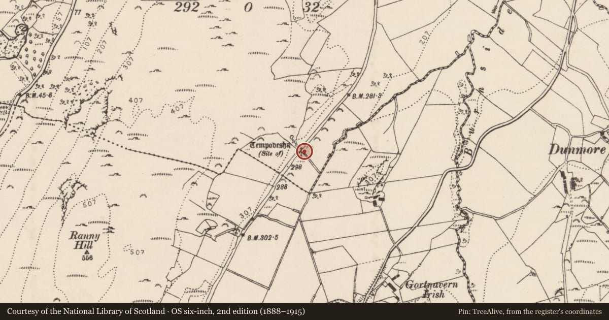
- Tempodesha
- Latest-edition OS map
- Tempodesha (Site of)
- Coordinates
- 55.12750, -7.66596
- SMR number
- DG027-019001-
Slide toward Today to fade the historical sheet and see the modern map underneath.
David Rumsey Map Collection, Stanford LibrariesDavid Rumsey Map Collection, Stanford LibrariesDavid Rumsey Map Collection, Stanford LibrariesDavid Rumsey Map Collection, Stanford Libraries
4 historical maps cover this location, the earliest the 1881 map "Ireland to Illustrate the Military Condition of the Country." (David Rumsey Map Collection, Stanford Libraries).
Historical maps covering this location
- 1881 · Ireland to Illustrate the Military Condition of the Country. (David Rumsey Map Collection, Stanford Libraries)
- 1891 · Ireland 16 (David Rumsey Map Collection, Stanford Libraries)
- 1900 · Ireland (David Rumsey Map Collection, Stanford Libraries)
- 1904 · Sheet 1. (David Rumsey Map Collection, Stanford Libraries)
This record in the National Monuments Service's Historic Environment Viewer ↗
The National Monuments Service's description
A well (DG027-019----) which is depicted on the current edition of the Ordnance Survey six-inch located a few metres NW of a possible church marked on the map as 'Tempodesha (Site of)'. Recorded by Kinahan in 1889/90 as 'at the N.E. of this townland there is a well called Tempodesha; but any old church that may formerly have existed has disappeared' (Kinahan 1889-90, 278).
Kinahan, G. H. (1889-90) 'Additional List of Megalithic and Other Ancient Structures, Barony of Kilmacrenan, CountyDonegal', Journal of the Royal Historical and Archaeological Association of Ireland, FourthSeries, Vol. 9, pp. 277-286.
Compiled by Caimin O'Brien
Date of upload/revision: 02 November 2011
Nearby in the register
- Ritual site - holy wellunder 1 mi
- Enclosureunder 1 mi
- Moundunder 1 mi
- Enclosureunder 1 mi
Other entries of the same register within about three miles of this one, by straight line.