Sites and Monuments Record · Ireland
Architectural fragment
Clonca, County Donegal, Ireland
The record
- Townland
- Clonca
- County
- Donegal
- Country
- Ireland
- Coordinates
- 55.26787, -7.17352
- SMR number
- DG012-002002-
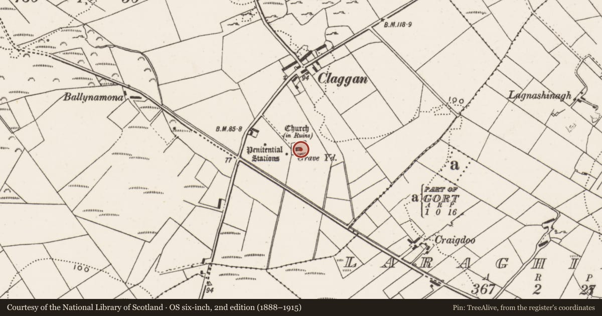
Slide toward Today to fade the historical sheet and see the modern map underneath.
David Rumsey Map Collection, Stanford LibrariesDavid Rumsey Map Collection, Stanford LibrariesDavid Rumsey Map Collection, Stanford LibrariesDavid Rumsey Map Collection, Stanford Libraries
4 historical maps cover this location, the earliest the 1841 map "Ireland." (David Rumsey Map Collection, Stanford Libraries).
Historical maps covering this location
- 1841 · Ireland. (David Rumsey Map Collection, Stanford Libraries)
- 1881 · Ireland to Illustrate the Military Condition of the Country. (David Rumsey Map Collection, Stanford Libraries)
- 1883 · Scotland. (David Rumsey Map Collection, Stanford Libraries)
- 1900 · Ireland (David Rumsey Map Collection, Stanford Libraries)
This record in the National Monuments Service's Historic Environment Viewer ↗
The National Monuments Service's description
This record refers to displaced fragments of cut stone which came from the 17th-century church (DG012-002001-). Doherty (1891, 52) records that the E window of the church was originally of cut stone, and that many of the dressed fragments and mullions were scattered on the ground. They were not located by the Donegal Survey. (Lacy et al. 1983, 254, no. 1539).
Date of upload: 13 January 2020
References
Lacy, B. with Cody, E., Cotter, C., Cuppage, J., Dunne, N., Hurley, V., O'Rahilly, C., Walsh, P. and Ó Nualláin, S. 1983 Archaeological Survey of County Donegal. A description of the field antiquities of the County from the Mesolithic Period to the 17th century A.D. Lifford. Donegal County Council.
Doherty, W.J. 1891 Inis-owen and Tirconnell: notes, antiquarian and topographical. Patrick Traynor, Dublin.
Nearby in the register
Other entries of the same register within about three miles of this one, by straight line.