Sites and Monuments Record · Ireland
Moated site
Tobinstown, County Carlow, Ireland
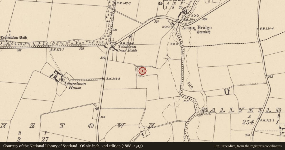
The record
- Townland
- Tobinstown
- County
- Carlow
- Country
- Ireland
- First-edition OS map
- Indicated
- Latest-edition OS map
- Hachured
- Coordinates
- 52.84278, -6.66871
- SMR number
- CW009-005----
Slide toward Today to fade the historical sheet and see the modern map underneath.
David Rumsey Map Collection, Stanford LibrariesDavid Rumsey Map Collection, Stanford LibrariesDavid Rumsey Map Collection, Stanford LibrariesDavid Rumsey Map Collection, Stanford Libraries
4 historical maps cover this location, the earliest the 1790 map "Composite: Ireland." (David Rumsey Map Collection, Stanford Libraries).
Historical maps covering this location
- 1790 · Composite: Ireland. (David Rumsey Map Collection, Stanford Libraries)
- 1799 · Ireland. (David Rumsey Map Collection, Stanford Libraries)
- 1830 · V.3:11-15:XV. Britisches Reich. C. Kon: Ireland. a. Prov: Leinster. Counties: 1-12 (David Rumsey Map Collection, Stanford Libraries)
- 1891 · Ireland 16 (David Rumsey Map Collection, Stanford Libraries)
This record in the National Monuments Service's Historic Environment Viewer ↗
The National Monuments Service's description
Situated on gentle NE facing slope overlooking Derreen River 220m to E. A natural gully or shallow ravine running E-W can be seen immediately N of the monument. Present remains consist of a rectangular area (48.4m N-S, 43.8m E-W) surrounded by well-defined flat-topped earth and stone bank (Wth 2m; int. H 1.3m; ext. H 0.7-2m) and deep wide flat-bottomed external fosse (Wth 3m; ext. D 1-2m). Entrance gap (Wth 4m) close to centre in E side. The enclosing fosse is visible from NE-E-S-W-NW and is best preserved from S to W. Second outer bank exists at E only, not clear if this second bank is an original feature or the remains of a post-1700 field boundary. Traces of shallow fosse 25m E of outer bank probably indicates adjacent enclosed field of post 1700 date. S half of interior of moated site now covered in thorn bushes, while N half of monument in pasture.
The above description is derived from the published 'Archaeological Inventory of County Carlow' (Dublin: Stationery Office, 1993). In certain instances the entries have been revised and updated in the light of recent research.
Date of upload/revision: 14 April 2014
Nearby in the register
- Fulacht fiaunder 1 mi
- Megalithic tomb - portal tombunder 1 mi
- Ringfort - rathunder 1 mi
- Religious house - Augustinian friarsunder 1 mi
Other entries of the same register within about three miles of this one, by straight line.