Sites and Monuments Record · Ireland
Religious house - Augustinian friars
Lisnevagh,Tobinstown, County Carlow, Ireland
The record
- Townland
- Lisnevagh,Tobinstown
- County
- Carlow
- Country
- Ireland
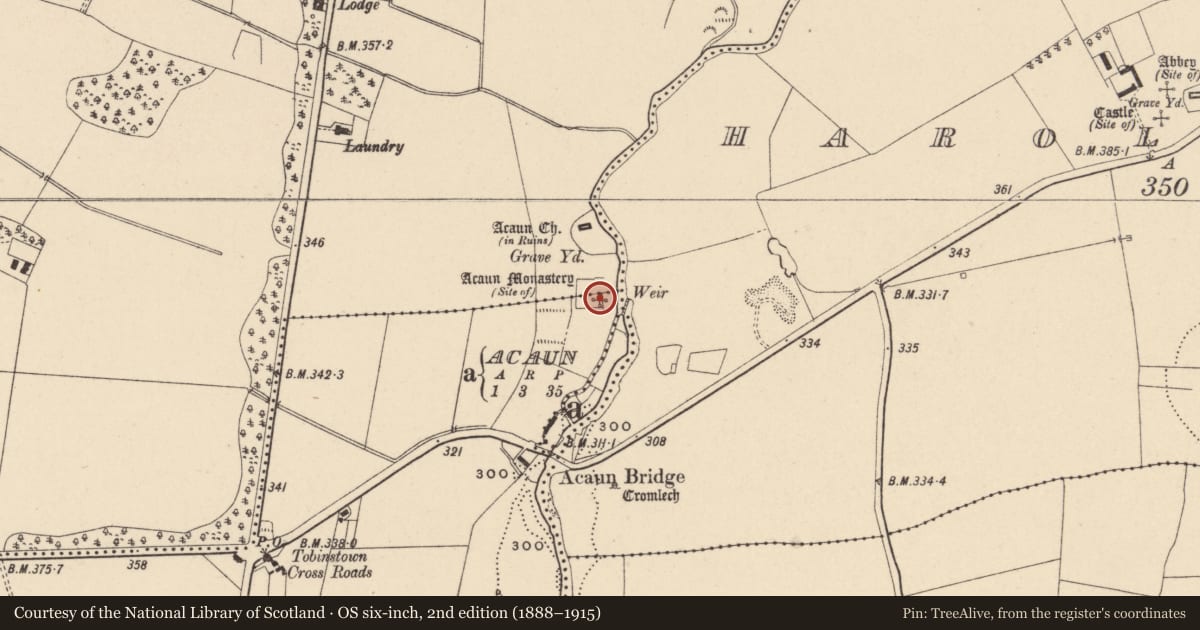
- First-edition OS map
- Acaun Monastery (in ruins)
- Latest-edition OS map
- Acaun Monastery (Site of).
- Coordinates
- 52.84746, -6.66429
- SMR number
- CW009-007----
Slide toward Today to fade the historical sheet and see the modern map underneath.
David Rumsey Map Collection, Stanford LibrariesDavid Rumsey Map Collection, Stanford LibrariesDavid Rumsey Map Collection, Stanford LibrariesDavid Rumsey Map Collection, Stanford Libraries
4 historical maps cover this location, the earliest the 1790 map "Composite: Ireland." (David Rumsey Map Collection, Stanford Libraries).
Historical maps covering this location
- 1790 · Composite: Ireland. (David Rumsey Map Collection, Stanford Libraries)
- 1799 · Ireland. (David Rumsey Map Collection, Stanford Libraries)
- 1830 · V.3:11-15:XV. Britisches Reich. C. Kon: Ireland. a. Prov: Leinster. Counties: 1-12 (David Rumsey Map Collection, Stanford Libraries)
- 1891 · Ireland 16 (David Rumsey Map Collection, Stanford Libraries)
This record in the National Monuments Service's Historic Environment Viewer ↗
The National Monuments Service's description
The following description is derived from the published 'Archaeological Inventory of County Carlow' (Dublin: Stationery Office, 1993). In certain instances the entries have been revised and updated in the light of recent research.
Date of upload/revision: 17 July 2007
Rectangular area enclosed by low bank with external stone-faced fosse (CW009-007001-), in which stand foundations of tower (CW009-007002-) (dims. 6.6m x 4.5m) with rectangular structure (CW009-007003-) aligned N-S (min. L 20m N-S; 5.5m E-W) attached to E wall of tower. Small annexe (4m x 4.5m) projects from SE corner. Leat leads from SE corner of fosse, dividing to run into and out of Derreen River to E of complex. Field system (CW009-007004-) to S of moated site. According to O'Toole (JKAS 1932, 71-74), may have belonged to Augustinian Order. (Gwynn and Haadcock 1988, 368; Comerford 1886, vol III, 352-3)
References
Comerford, Rev. M. 1883-6 Collections relating to the dioceses of Kildare and Leighlin, 3 vols. James Duffy and Sons. Dublin.
Gwynn, A. and Hadcock, R.N. 1970 (Reprint 1988) Medieval religious houses of Ireland. Dublin. Irish Academic Press.
Nearby in the register
- Moated siteunder 1 mi
- Structureunder 1 mi
- Structureunder 1 mi
- Field systemunder 1 mi
Other entries of the same register within about three miles of this one, by straight line.